MyTopo
Renick Missouri US Topo Map
Couldn't load pickup availability
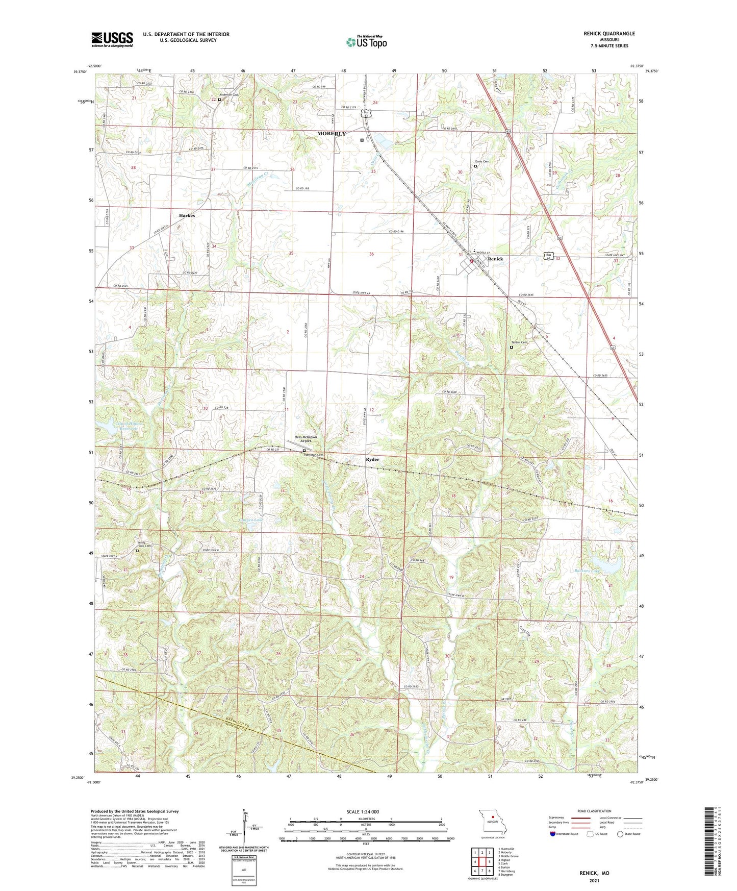
2021 topographic map quadrangle Renick in the state of Missouri. Scale: 1:24000. Based on the newly updated USGS 7.5' US Topo map series, this map is in the following counties: Randolph, Howard. The map contains contour data, water features, and other items you are used to seeing on USGS maps, but also has updated roads and other features. This is the next generation of topographic maps. Printed on high-quality waterproof paper with UV fade-resistant inks.
Quads adjacent to this one:
West: Higbee
Northwest: Huntsville
North: Moberly
Northeast: Middle Grove
East: Clark
Southeast: Sturgeon
South: Harrisburg
Southwest: Burton
This map covers the same area as the classic USGS quad with code o39092c4.
Contains the following named places: Anderson Cemetery, Backues Lake, Backues Lake Dam, City of Higbee Dam, City of Higbee Reservoir, Davis Cemetery, Fairview Church, Fairview School, Gonyea Lake, Gonyea Lake Dam, Hamilton Cemetery, Harkes, Hess-McKeown Airport, Little Perche Creek, Moberly Correctional Center, Oak Grove School, Patton School, Renick, Renick Elementary School, Renick Post Office, Ryder, Sandy Hook Cemetery, Southeastern Randolph Fire Protection District Renick, Tanton Cemetery, Township of Prairie, Village of Renick, West Point School, Wilson School, ZIP Code: 65278