MyTopo
New Franklin Missouri US Topo Map
Couldn't load pickup availability
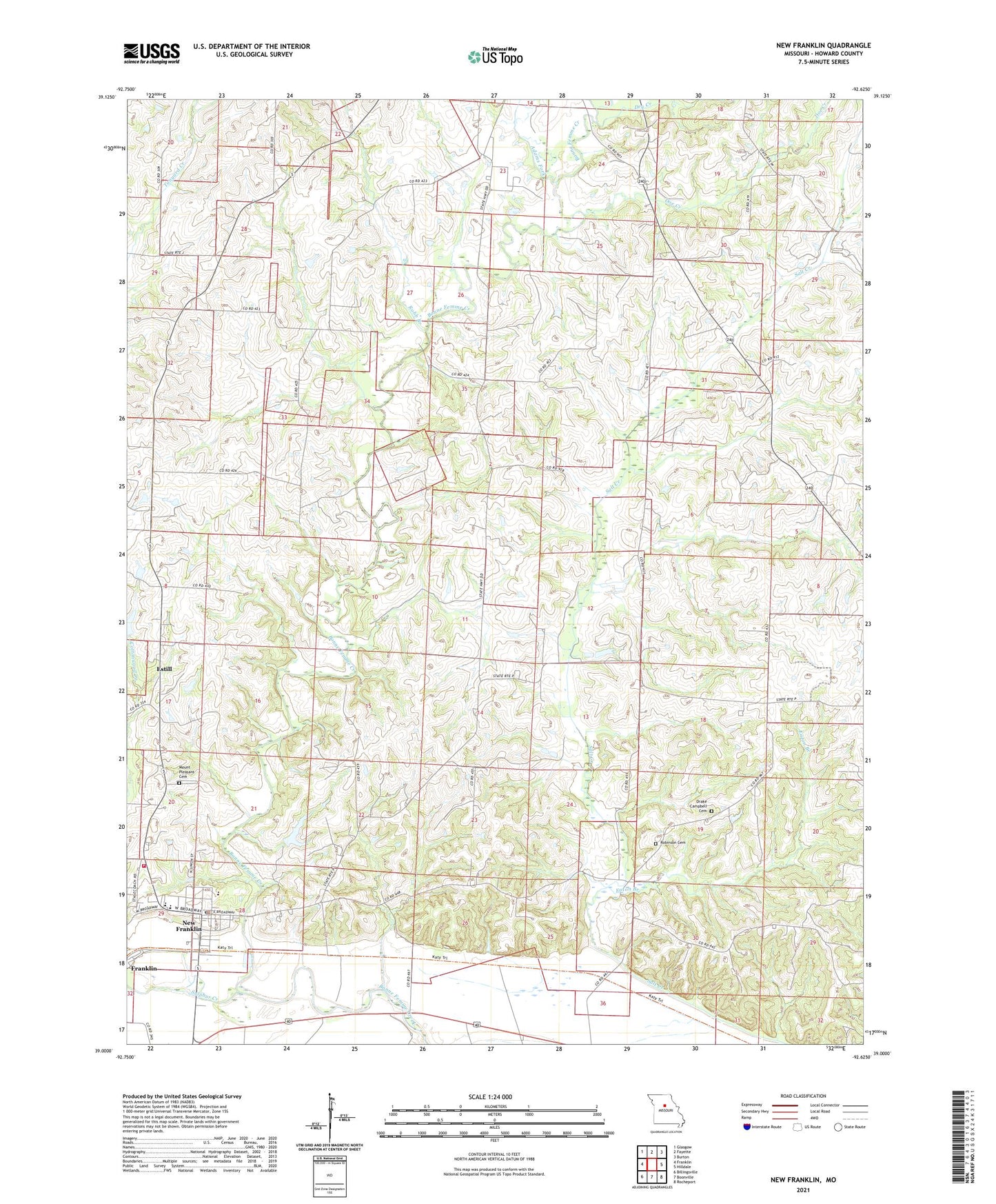
2021 topographic map quadrangle New Franklin in the state of Missouri. Scale: 1:24000. Based on the newly updated USGS 7.5' US Topo map series, this map is in the following counties: Howard. The map contains contour data, water features, and other items you are used to seeing on USGS maps, but also has updated roads and other features. This is the next generation of topographic maps. Printed on high-quality waterproof paper with UV fade-resistant inks.
Quads adjacent to this one:
West: Franklin
Northwest: Glasgow
North: Fayette
Northeast: Burton
East: Hilldale
Southeast: Rocheport
South: Boonville
Southwest: Billingsville
This map covers the same area as the classic USGS quad with code o39092a6.
Contains the following named places: Adams Fork, Boonslick, Buckharts, Cedar Grove School, Central Hill School, Cherry Grove School, City of New Franklin, Davis Lake Dam, Doe Creek, Drake - Campbell Cemetery, Dry Creek, Dudgeon School, Eaton Branch, Estill, Fayette Flying Field, Gray School, Howell Lake Dam, Mount Pleasant Cemetery, Mount Zion Church, Mount Zion School, New Franklin, New Franklin Elementary School, New Franklin Fire Department Howard County Fire Protection District Station 2, New Franklin High School, New Franklin Police Department, New Franklin Post Office, Robb Branch, Robinson Cemetery, Rosalee, Spanish Needles School, Sulphur Creek, Talbot, Township of Franklin, Turner School, White Hall School, ZIP Code: 65274