MyTopo
California North Missouri US Topo Map
Couldn't load pickup availability
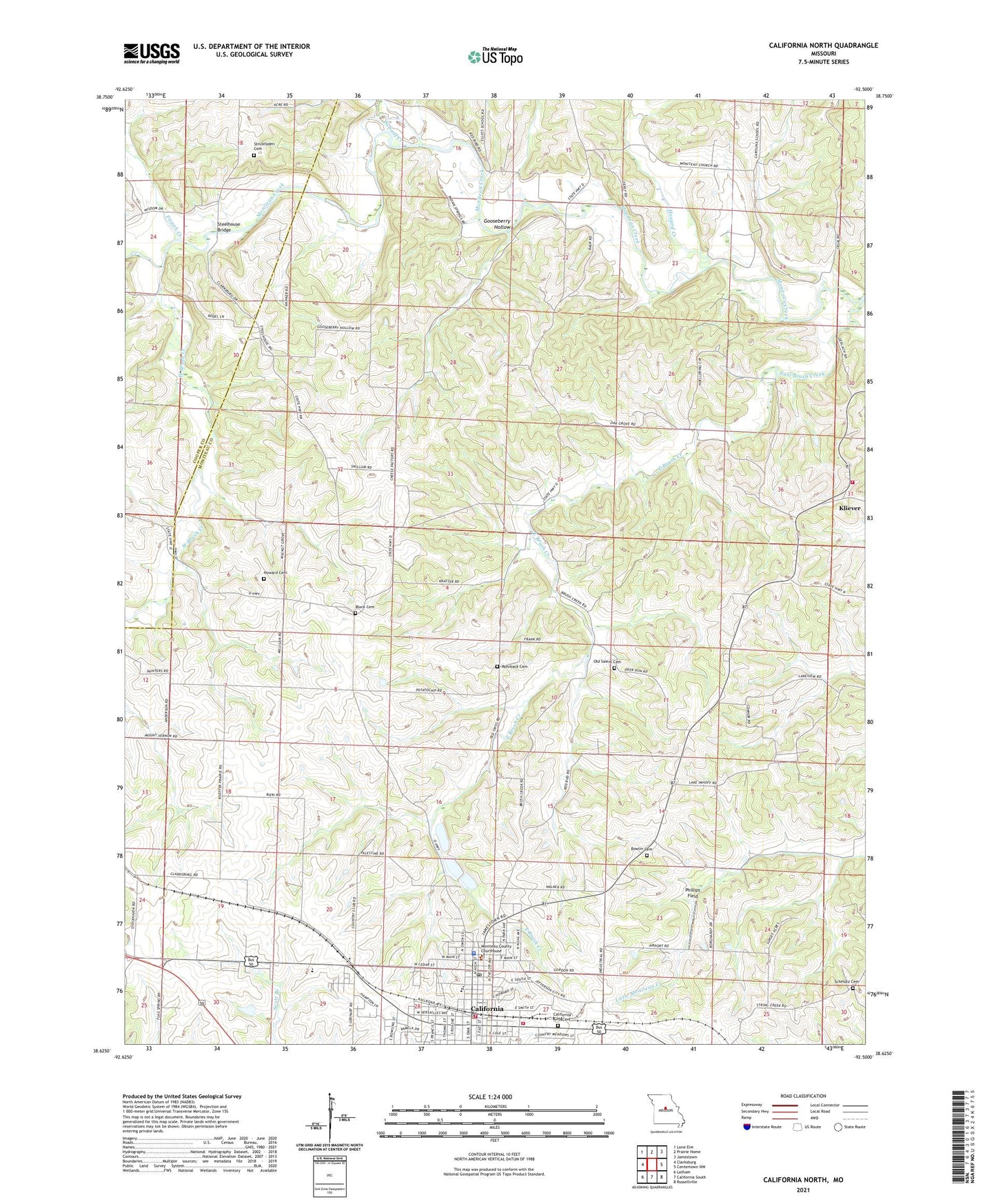
2021 topographic map quadrangle California North in the state of Missouri. Scale: 1:24000. Based on the newly updated USGS 7.5' US Topo map series, this map is in the following counties: Moniteau, Cooper. The map contains contour data, water features, and other items you are used to seeing on USGS maps, but also has updated roads and other features. This is the next generation of topographic maps. Printed on high-quality waterproof paper with UV fade-resistant inks.
Quads adjacent to this one:
West: Clarksburg
Northwest: Lone Elm
North: Prairie Home
Northeast: Jamestown
East: Centertown NW
Southeast: Russellville
South: California South
Southwest: Latham
Contains the following named places: Aurora High School, Block Cemetery, Bowlin Cemetery, California, California City Cemetery, California City Fire Department, California Elementary School, California High School, California Middle School, California Police Department, California Post Office, California Rural Fire Protection District Kliever Fire Station, California Rural Fire Protection District Main Station, City of California, Department of Conservation California Central Field Fire Office, East Brush Creek, Gooseberry Hollow, High Prairie School, Highland School, Howard Cemetery, Howard Creek, Kliever, Kraemer School, KZMO-AM (California), KZMO-FM (California), Martin School, Moniteau Church, Moniteau County, Moniteau County Sheriff's Office, New Salem Church, North Carolina School, Number 576 Dam, Oak Grove School, Old Salem Cemetery, Old Salem Church, Phillips Field, Pisgah Creek, Pleasant Ridge School, Rohrback Cemetery, Schaaf Creek, Schmutz Cemetery, South Carolina School, Steelhouse Bridge, Strickfaden Cemetery, Township of Walker, Walnut Grove School, West Brush Creek