MyTopo
Latham Missouri US Topo Map
Couldn't load pickup availability
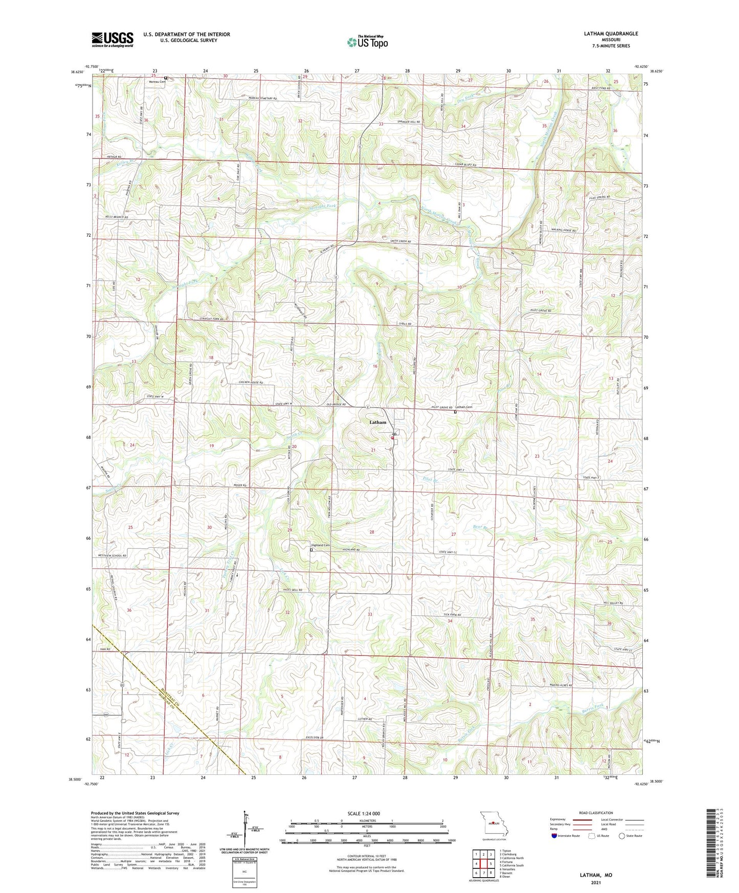
2021 topographic map quadrangle Latham in the state of Missouri. Scale: 1:24000. Based on the newly updated USGS 7.5' US Topo map series, this map is in the following counties: Moniteau, Morgan. The map contains contour data, water features, and other items you are used to seeing on USGS maps, but also has updated roads and other features. This is the next generation of topographic maps. Printed on high-quality waterproof paper with UV fade-resistant inks.
Quads adjacent to this one:
West: Fortuna
Northwest: Tipton
North: Clarksburg
Northeast: California North
East: California South
Southeast: Olean
South: Barnett
Southwest: Versailles
This map covers the same area as the classic USGS quad with code o38092e6.
Contains the following named places: Bethel Church, Elliott Lake Dam, Fortuna Fire Protection District Latham, Green Grove Church, Green Grove School, Hazel Dell School, Highland Cemetery, Independence School, Kelley Branch, Latham, Latham Cemetery, Latham Census Designated Place, Latham Elementary School, Latham Post Office, Lick Creek, Lone Oak School, Moreau Cemetery, Oak Dale School, Pilot Branch, Pilot Grove Church, Pilot School, Pleasant Hill School, Pleasant View School, Porter Lake Dam, R Elliott Lake, Smith Creek, Straight Fork, Township of Pilot Grove, Turkey Trot Creek, Willow Fork, Zimmerman Lake Dam, ZIP Code: 65050