MyTopo
Saline City Missouri US Topo Map
Couldn't load pickup availability
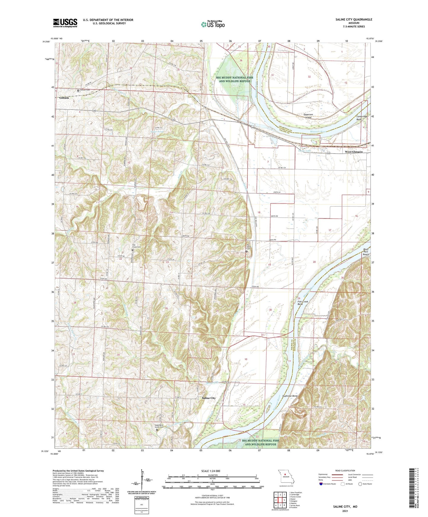
2021 topographic map quadrangle Saline City in the state of Missouri. Scale: 1:24000. Based on the newly updated USGS 7.5' US Topo map series, this map is in the following counties: Saline, Howard, Chariton. The map contains contour data, water features, and other items you are used to seeing on USGS maps, but also has updated roads and other features. This is the next generation of topographic maps. Printed on high-quality waterproof paper with UV fade-resistant inks.
Quads adjacent to this one:
West: Slater
Northwest: New Frankfort
North: Cambridge
Northeast: Forest Green
East: Glasgow
Southeast: Franklin
South: Arrow Rock
Southwest: Napton
This map covers the same area as the classic USGS quad with code o39092b8.
Contains the following named places: All Saints Cemetery, Annaheim School, Bluffport, Buzzard Branch, Cambridge Bend, Chocolate Creek, Elm Grove School, Epperson Island, Euphrase Bend, Fish Creek, Fish Creek Bend, Fish Creek Church, Gilliam Cemetery, Linridge School, Pleasant Hill School, Pleasant Valley School, Richland Creek, Riverview School, Saint Paul Church, Saint Pauls School, Saline City, Saline Valley School, Sappington Grove Cemetery, Slater Pond, Turtle Lake, West Glasgow, ZIP Code: 65330