MyTopo
Camdenton Missouri US Topo Map
Couldn't load pickup availability
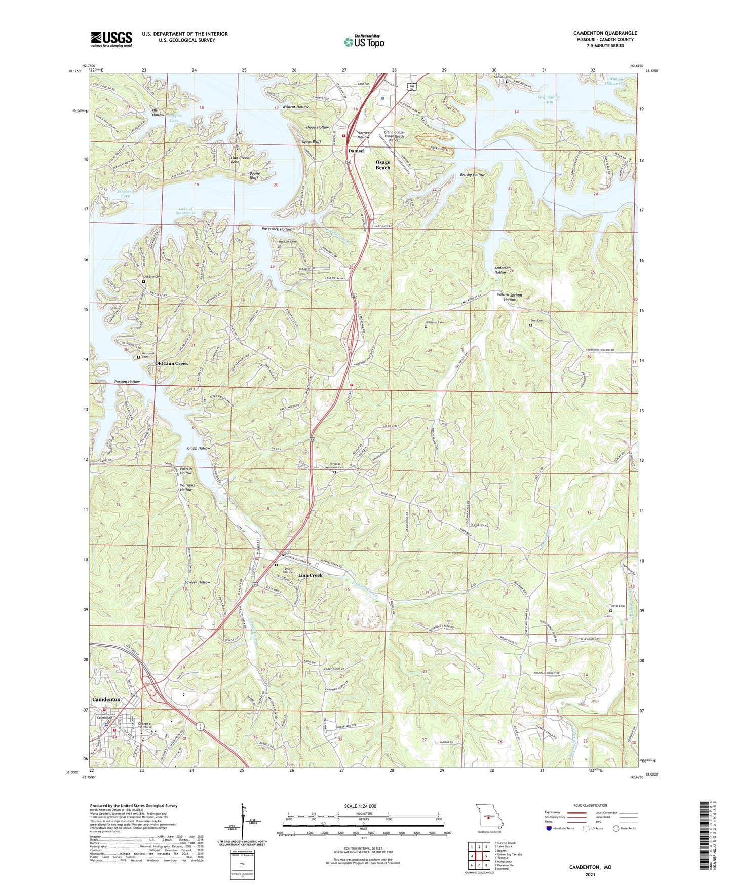
2021 topographic map quadrangle Camdenton in the state of Missouri. Scale: 1:24000. Based on the newly updated USGS 7.5' US Topo map series, this map is in the following counties: Camden. The map contains contour data, water features, and other items you are used to seeing on USGS maps, but also has updated roads and other features. This is the next generation of topographic maps. Printed on high-quality waterproof paper with UV fade-resistant inks.
Quads adjacent to this one:
West: Green Bay Terrace
Northwest: Sunrise Beach
North: Lake Ozark
Northeast: Bagnell
East: Toronto
Southeast: Montreal
South: Decaturville
Southwest: Hahatonka
This map covers the same area as the classic USGS quad with code o38092a6.
Contains the following named places: Anderson Hollow, Anderson Hollow School, Blue Springs Branch, Boone Bluff, Brushy Hollow, Camden County Sheriff's Office, Camdenton, Camdenton Fire Department, Camdenton High School, Camp Clover Point, Camp Hawthorn, Camp Pa He Tsi, Camp Pin Oak, Church of Christ, City of Camdenton, City of Linn Creek, Clopp Hollow, Conway Cemetery, Conway School, Crabtree Cove, Damsel, Davis Cemetery, Grand Glaize-Osage Beach Airport, Heritage Landing Strip, Hill Hollow, Hopkins Cemetery, Hospital Property Heliport, Hunter Mine, KADI-AM (Camdenton), KRMS-AM (Osage Beach), KYLC-FM (Osage Beach), Lake Regional Health System, Linn Creek, Linn Creek Bend, Linn Creek Church, Linn Creek Police Department, Linn Creek Post Office, Lyons Bluff, Memorial Cemetery, Mid County Fire Protection District Station 1 Headquarters, North Fork Linn Creek, Old Erie Cemetery, Old Linn Creek, Osage Beach Fire Protection District Station 2, Osage Beach Fire Protection District Station 3, Outlets Limited, Parrish Hollow, Percival Memorial Cemetery, Possum Hollow, Racetrack Hollow, Rodeo Arena, Sawyer Hollow, Selby - Hall Cemetery, Shepherd Cove, Shoop Hollow, South Fork Linn Creek, Steinberg Lake Dam, Township of Kiheka, Township of Osage, Township of Pawhuska, Voc-Tech School, Wildcat Hollow, Williams Cemetery, Williams Hollow, Willow Springs Hollow, Zion Cemetery, Zion Church