MyTopo
Toronto Missouri US Topo Map
Couldn't load pickup availability
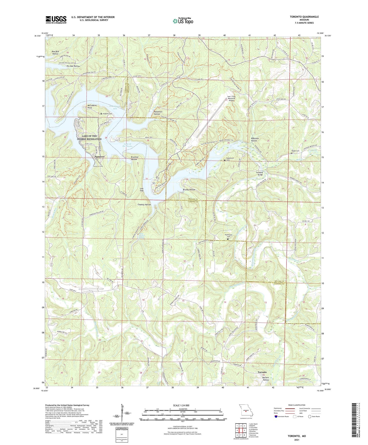
2023 topographic map quadrangle Toronto in the state of Missouri. Scale: 1:24000. Based on the newly updated USGS 7.5' US Topo map series, this map is in the following counties: Camden, Miller. The map contains contour data, water features, and other items you are used to seeing on USGS maps, but also has updated roads and other features. This is the next generation of topographic maps. Printed on high-quality waterproof paper with UV fade-resistant inks.
Quads adjacent to this one:
West: Camdenton
Northwest: Lake Ozark
North: Bagnell
Northeast: Tuscumbia
East: Brumley
Southeast: Conns Creek
South: Montreal
Southwest: Decaturville
This map covers the same area as the classic USGS quad with code o38092a5.
Contains the following named places: Auglaize Cemetery, Barnett Hollow, Brashear Hollow, Brumley Creek, Brushy Hollow, Camp Rising Sun, China School, Church of Christ, Coakley Hollow, Deane Creek, Dry Auglaize Creek, Fort Leonard Wood Recreation Area, Freedom, Freedom School, Grandglaize Arm, Grandglaize Creek, Honey Run, Jefferies School, Kaiser Lookout Tower, Kuykendall Cemetery, Lake of the Ozarks State Park, Lee C Fine Memorial Airport, Low Gap, McCubbins Point, Mill Creek, New Hope Church, Passover, Passover School, Patterson Hollow, Pin Oak Hollow, Popplewell Cemetery, Red Bud Hollow, Reed School, Robinson Hollow, Rodden Church, Snyder School, Swinging Bridge, Toronto, Township of Jackson, Wet Glaize Creek, White Sulphur Spring, Wright Cemetery, ZIP Code: 65052