MyTopo
Caplinger Mills Missouri US Topo Map
Couldn't load pickup availability
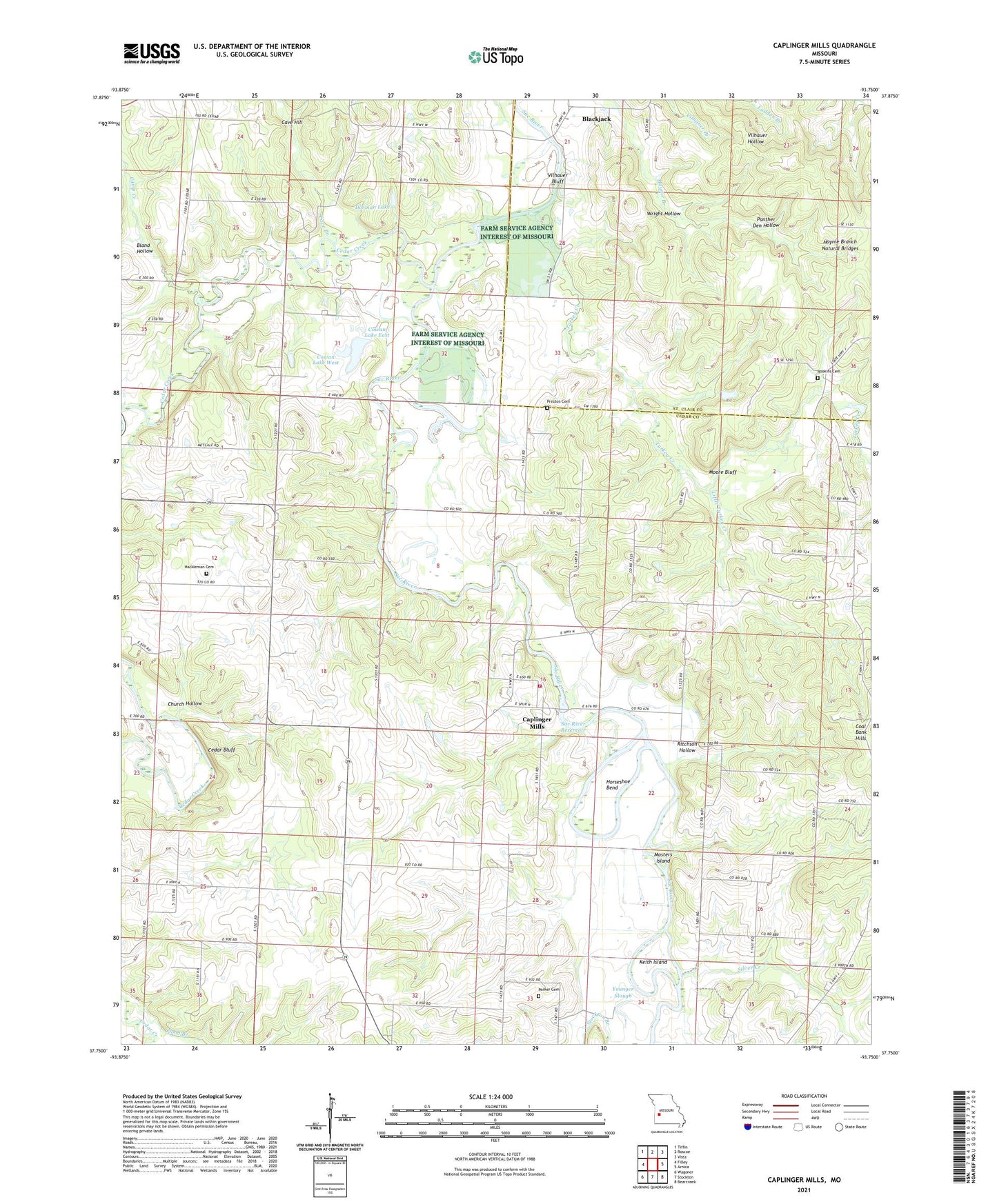
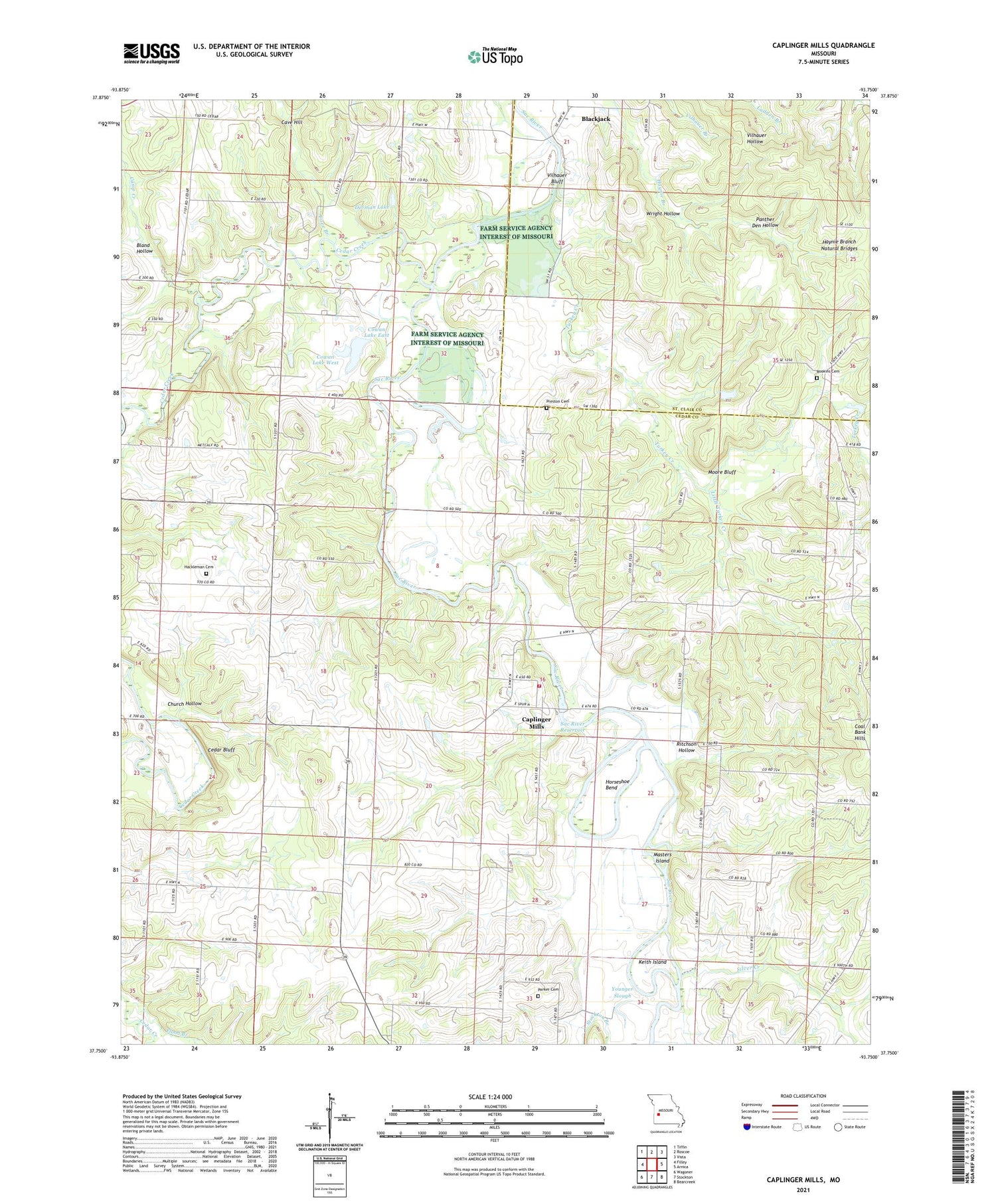
2021 topographic map quadrangle Caplinger Mills in the state of Missouri. Scale: 1:24000. Based on the newly updated USGS 7.5' US Topo map series, this map is in the following counties: Cedar, St. Clair. The map contains contour data, water features, and other items you are used to seeing on USGS maps, but also has updated roads and other features. This is the next generation of topographic maps. Printed on high-quality waterproof paper with UV fade-resistant inks.
Quads adjacent to this one:
West: Filley
Northwest: Tiffin
North: Roscoe
Northeast: Vista
East: Arnica
Southeast: Bearcreek
South: Stockton
Southwest: Wagoner
Contains the following named places: Blackjack, Blackjack School, Bland Hollow, Bluff Springs School, Camp Creek, Caplinger Mills, Caplinger Mills Dam, Caplinger Mills School, Caplinger Mills Volunteer Fire Department, Cave Branch, Cave Hill, Cedar Bluff, Cedar Creek, Church Hollow, Cline Hill School, Coal Bank Hills, Cowan Lake East, Cowan Lake East Dam, Cowan Lake West, Cowan Lake West Dam, Dorman Lake, Dorman Lake Dam, Elliston School, Fairview, Flatrock School, Flood Branch, Graceland, Greenwood School, Hackleman Cemetery, Hackleman Corner, Hackleman Corner Lake, Haynie Branch Natural Bridges, Hickman Lake Dam, Horseshoe Bend, Ivy, Keith Island, Leila Store, Little Turkey Creek, Love School, Masters Island, Moore Bluff, Mount Enon School, Mount Olive School, Old Union Church, Panther Den Hollow, Parker Cemetery, Parker School, Preston Cemetery, Rich Hill School, Ritchson Hollow, Rock School, Rookins, Rookins Cemetery, Sac River Reservoir, Silver Creek, Spring Valley School, Stockton Branch, Township of Cedar, Township of Washington, Turkey Creek, Vilhauer Bluff, West Union Missionary Baptist Church, West Union School, Wright Hollow, Younger Slough