MyTopo
Wagoner Missouri US Topo Map
Couldn't load pickup availability
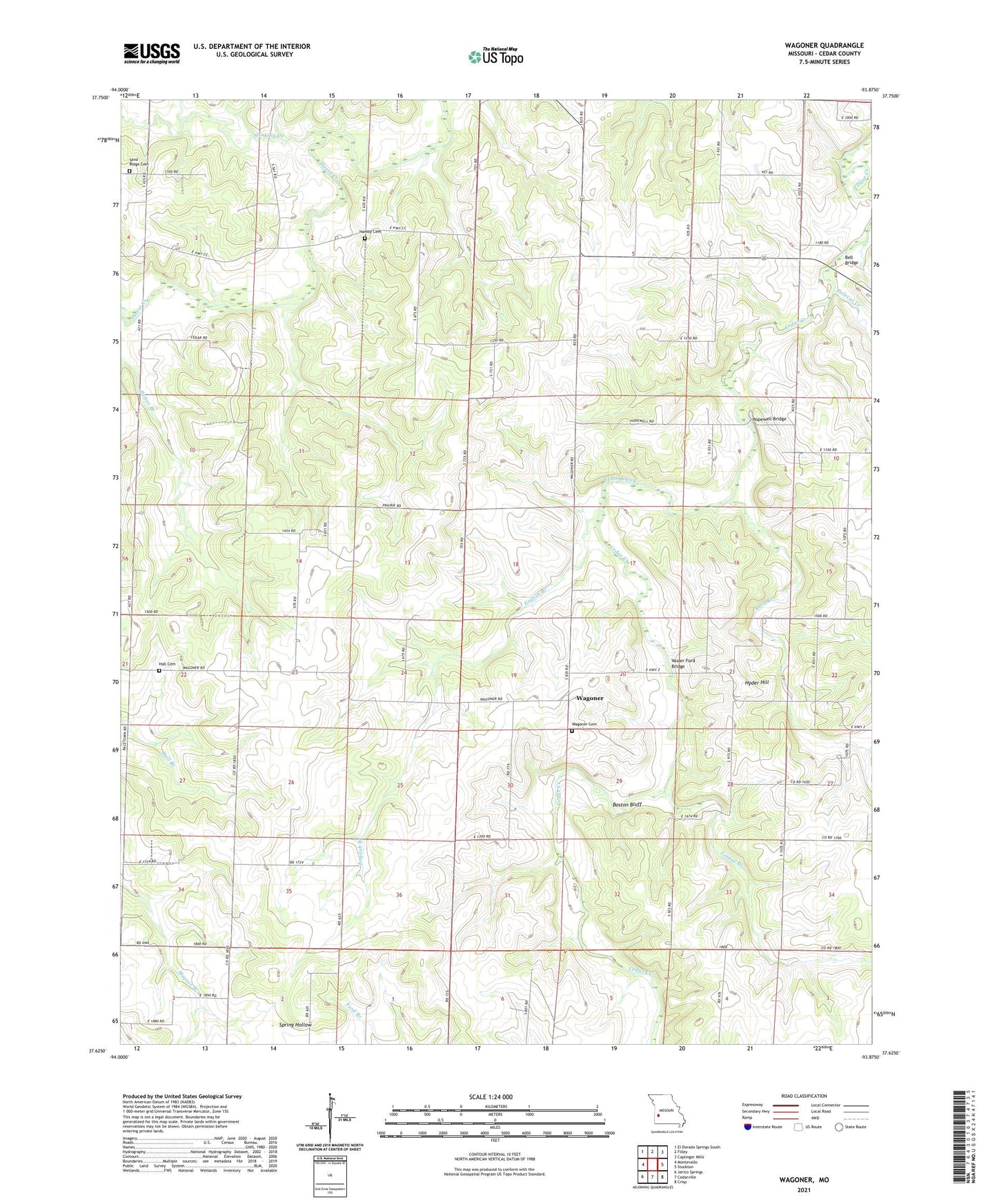
2021 topographic map quadrangle Wagoner in the state of Missouri. Scale: 1:24000. Based on the newly updated USGS 7.5' US Topo map series, this map is in the following counties: Cedar. The map contains contour data, water features, and other items you are used to seeing on USGS maps, but also has updated roads and other features. This is the next generation of topographic maps. Printed on high-quality waterproof paper with UV fade-resistant inks.
Quads adjacent to this one:
West: Montevallo
Northwest: El Dorado Springs South
North: Filley
Northeast: Caplinger Mills
East: Stockton
Southeast: Crisp
South: Cedarville
Southwest: Jerico Springs
This map covers the same area as the classic USGS quad with code o37093f8.
Contains the following named places: Amity Community Hall, Bell Bridge, Boston Bluff, Buckfoot Branch, Cedar Bluff School, Edsall, English Branch, Fowler School, Hall Cemetery, Hamby Cemetery, Highpoint School, Hopewell Bridge, Hopewell Church, Hudson School, Hyder Hill, Independence Church, Independence Community Hall, Lake Louise, Mossy Hill Dam, Polecat Creek, Potter School, Sand Ridge Cemetery, Sand Ridge School, Snag Branch, Stinking Creek, Teague Branch, Tingley, Vasser Ford Bridge, Wagoner, Wagoner Cemetery