MyTopo
Carrollton West Missouri US Topo Map
Couldn't load pickup availability
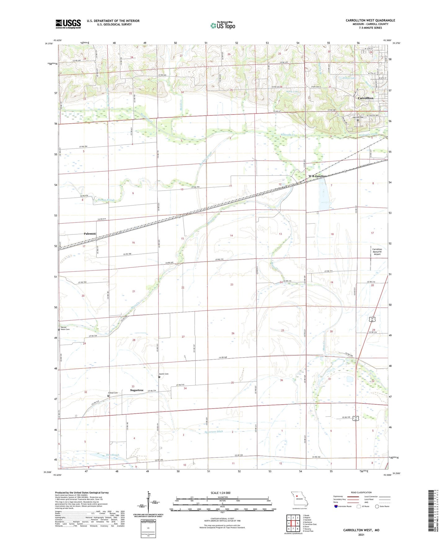
2021 topographic map quadrangle Carrollton West in the state of Missouri. Scale: 1:24000. Based on the newly updated USGS 7.5' US Topo map series, this map is in the following counties: Carroll. The map contains contour data, water features, and other items you are used to seeing on USGS maps, but also has updated roads and other features. This is the next generation of topographic maps. Printed on high-quality waterproof paper with UV fade-resistant inks.
Quads adjacent to this one:
West: Norborne
Northwest: Roads
North: Bogard
Northeast: Standish
East: Carrollton East
Southeast: Grand Pass
South: Waverly
Southwest: Dover
Contains the following named places: Austin Cemetery, Booker Slough, Bowdry, Bowdry Lake, Brush Creek, Carrollton Memorial Airport, Carrollton Recreation Lake, Carrollton Recreation Lake Dam, Costner School, Dick School, Dirt Slough, Fletcher School, Floyd School, Gilead Cemetery, Gilead Church, Hilton Lake, Hilton Lake Dam, KAOL-AM (Carrollton), Little Grover Branch, McGill Creek, Monk Lake, Monk Lake Dam, Moss Creek, New School, Oak Hill Cemetery, Old Channel Wakenda Creek, Palemon, Sacred Heart Cemetery, South Baker School, Stanley Branch, Sugartree, Sugartree Ditch, Township of Moss Creek, W B Junction, Wilson School