MyTopo
Standish Missouri US Topo Map
Couldn't load pickup availability
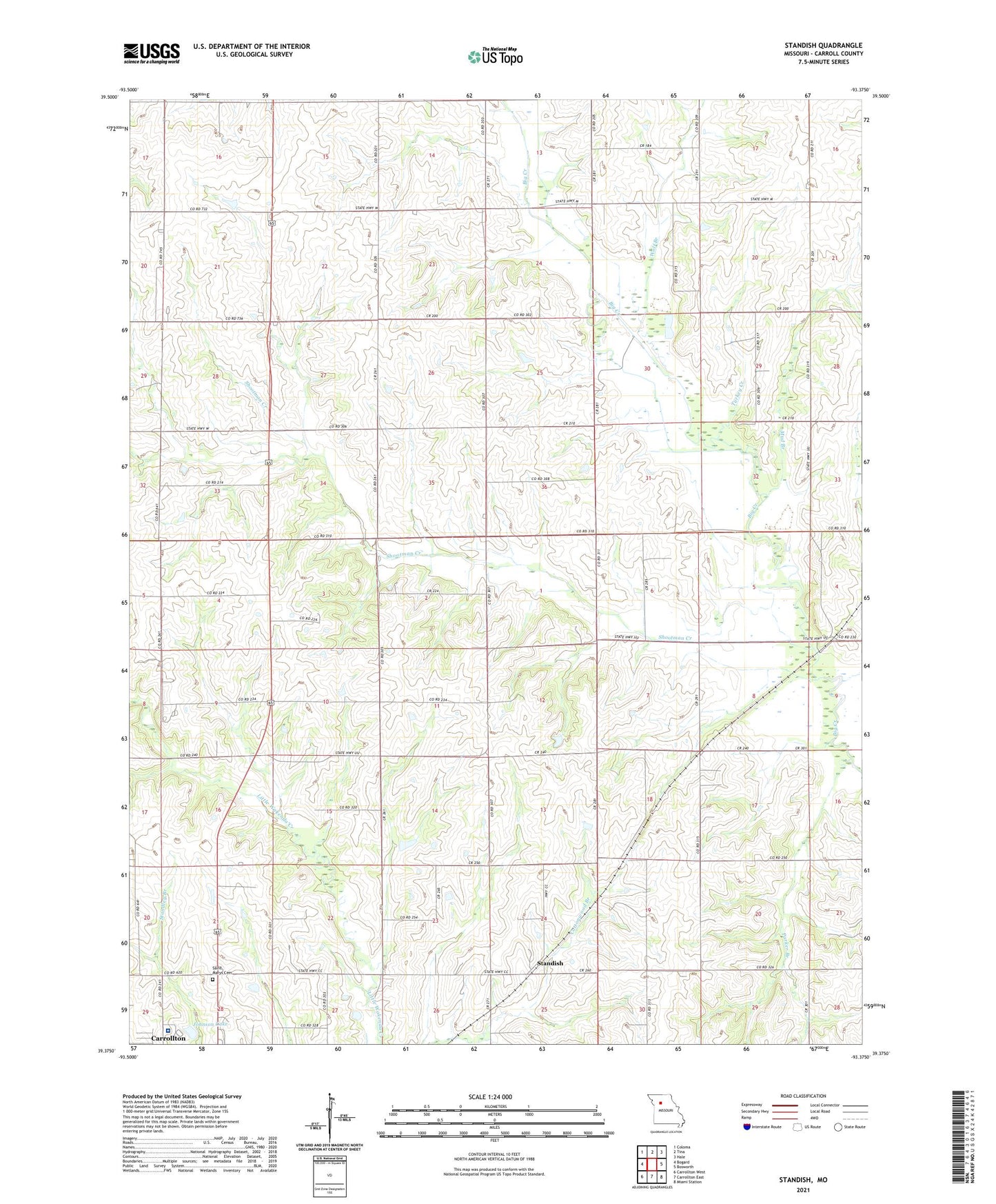
2021 topographic map quadrangle Standish in the state of Missouri. Scale: 1:24000. Based on the newly updated USGS 7.5' US Topo map series, this map is in the following counties: Carroll. The map contains contour data, water features, and other items you are used to seeing on USGS maps, but also has updated roads and other features. This is the next generation of topographic maps. Printed on high-quality waterproof paper with UV fade-resistant inks.
Quads adjacent to this one:
West: Bogard
Northwest: Coloma
North: Tina
Northeast: Hale
East: Bosworth
Southeast: Miami Station
South: Carrollton East
Southwest: Carrollton West
This map covers the same area as the classic USGS quad with code o39093d4.
Contains the following named places: Bethlehem Church, Big Creek Church, Carroll County Memorial Hospital, Center Grove School, Cottonwood School, Johnson Lake, Johnson Lake Dam, Liberty School, Mud Branch, Mud Branch School, North Baker School, Parker Branch, Pence Dam, Pence Lake, Pleasant Hill Church, Saint Marys Cemetery, Shootman Creek, Shootman School, Standish, Taylor School, Township of Carrollton, Township of Van Horn, Turkey Creek, Van Horn Church, Van Horn School, Whippoorwill School, Wolf Branch, Woods School