MyTopo
Carrollton East Missouri US Topo Map
Couldn't load pickup availability
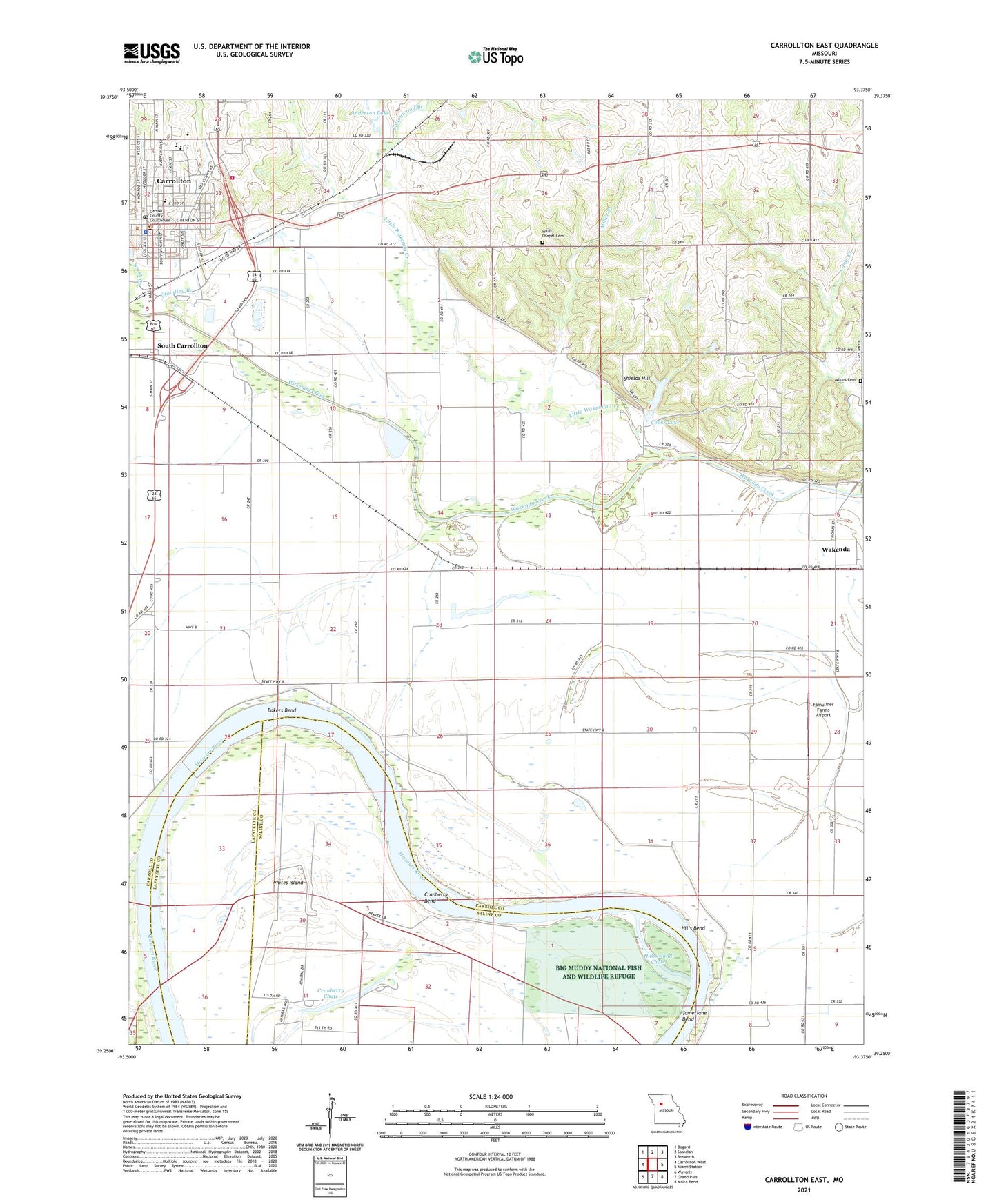
2021 topographic map quadrangle Carrollton East in the state of Missouri. Scale: 1:24000. Based on the newly updated USGS 7.5' US Topo map series, this map is in the following counties: Carroll, Saline, Lafayette. The map contains contour data, water features, and other items you are used to seeing on USGS maps, but also has updated roads and other features. This is the next generation of topographic maps. Printed on high-quality waterproof paper with UV fade-resistant inks.
Quads adjacent to this one:
West: Carrollton West
Northwest: Bogard
North: Standish
Northeast: Bosworth
East: Miami Station
Southeast: Malta Bend
South: Grand Pass
Southwest: Waverly
This map covers the same area as the classic USGS quad with code o39093c4.
Contains the following named places: Adams - Dieterich Elementary School, Adkins Cemetery, Anderson Lake, Anderson Lake Dam, Bakers Bend, Calvin, Carroll County Sheriff's Office, Carrollton, Carrollton Area Career Center, Carrollton Fire Department, Carrollton High School, Carrollton Junior High School, Carrollton Post Office, Cary School, City of Carrollton, Cooks Lake, Cooks Lake Dam, Cottonwood Branch, Cox School, Cranberry Bend, Cranberry Chute, Famuliner Farms Airport, Hills Bend, Hills Island Chute, KMZU-FM (Carrollton), Little Wakenda Creek, Mayview School, Miller Branch, Riverside School, Root Middle School, Rosebud School, Shields Hill, South Carrollton, Standley Branch, Township of Wakenda, Wakenda, Wakenda Church, Walnut Grove School, Wayside School, Whites Island, Willis Chapel Cemetery, ZIP Code: 64633