MyTopo
Center Missouri US Topo Map
Couldn't load pickup availability
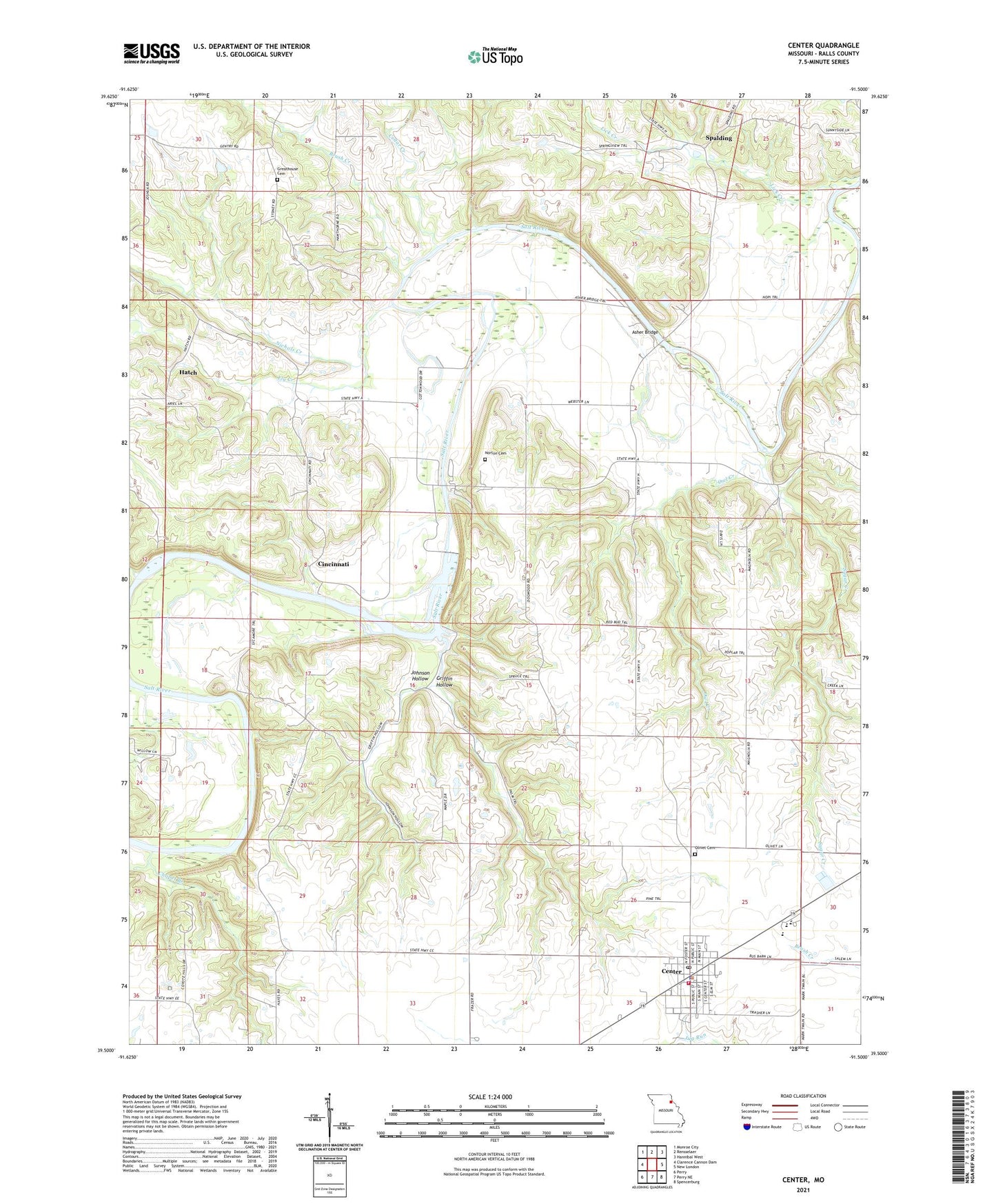
2021 topographic map quadrangle Center in the state of Missouri. Scale: 1:24000. Based on the newly updated USGS 7.5' US Topo map series, this map is in the following counties: Ralls. The map contains contour data, water features, and other items you are used to seeing on USGS maps, but also has updated roads and other features. This is the next generation of topographic maps. Printed on high-quality waterproof paper with UV fade-resistant inks.
Quads adjacent to this one:
West: Clarence Cannon Dam
Northwest: Monroe City
North: Rensselaer
Northeast: Hannibal West
East: New London
Southeast: Spencerburg
South: Perry NE
Southwest: Perry
This map covers the same area as the classic USGS quad with code o39091e5.
Contains the following named places: Ariel Church, Asher Bridge, Bluff View Recreation Area, Brashear Ford, Brush Creek, Cedar Creek, Center, Center Elementary School, Center Fire Department, Center Police Department, Center Post Office, Center Rural Fire Department, Chapel Branch, Cincinnati, City of Center, Crossroad Church, Ely Creek, Greathouse Cemetery, Griffin Hollow, Hatch, Hog Ford, Johnson Hollow, Johnson School, Linwood School, Little Ford, Magnolia School, Mark Twain High School, Mark Twain Junior High School, Nichols Creek, Norton Cemetery, Olivet Cemetery, Owl Creek, Ralls County, Re-Regulation Dam, Rocklick Branch, Saint Paul School, Saint Pauls Catholic Church, Saint Peters Brush Creek Catholic Church, Sidney School, Spalding, Sugar Creek, Township of Center, Webster School, ZIP Code: 63436