MyTopo
Monroe City Missouri US Topo Map
Couldn't load pickup availability
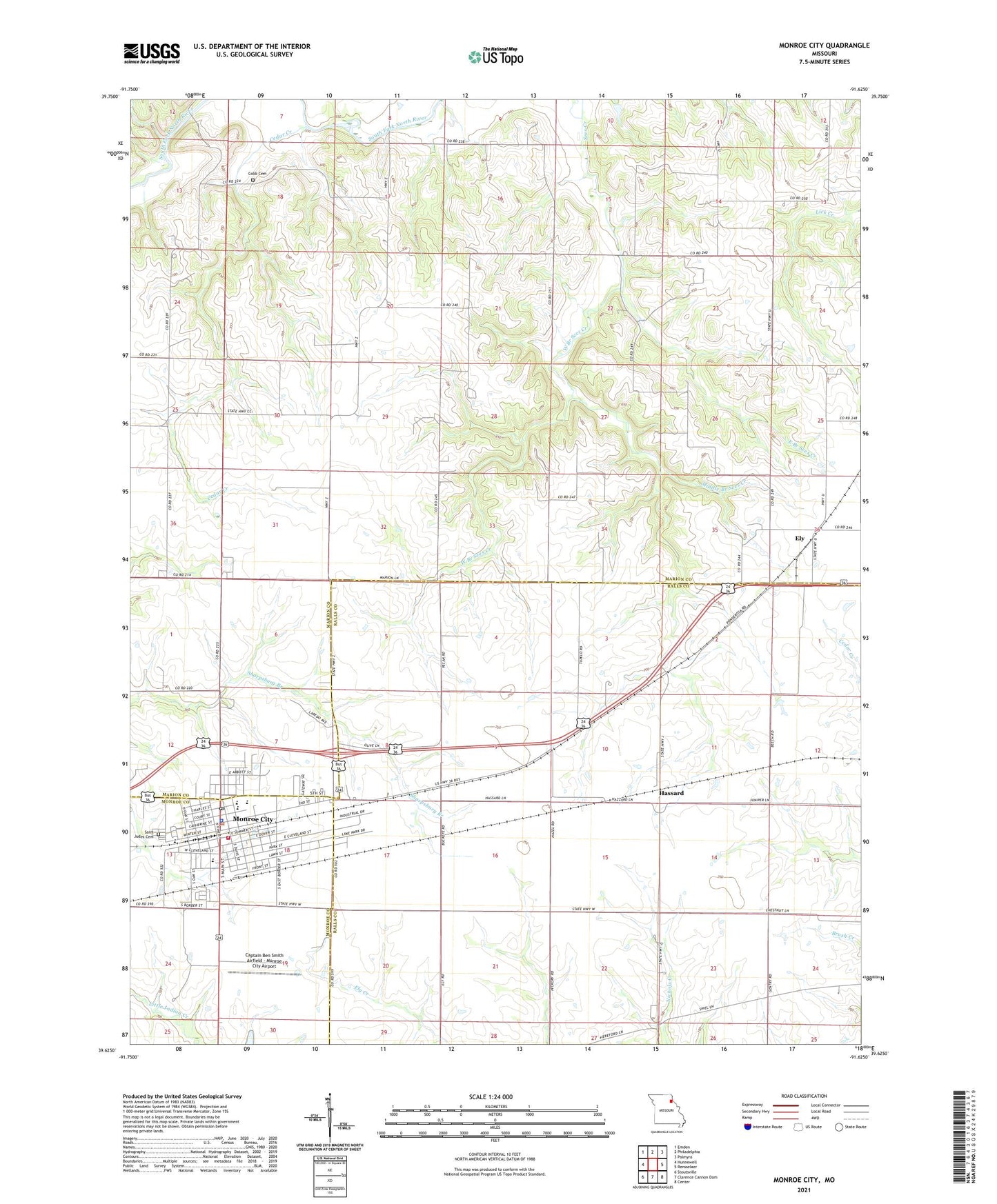
2021 topographic map quadrangle Monroe City in the state of Missouri. Scale: 1:24000. Based on the newly updated USGS 7.5' US Topo map series, this map is in the following counties: Marion, Ralls, Monroe. The map contains contour data, water features, and other items you are used to seeing on USGS maps, but also has updated roads and other features. This is the next generation of topographic maps. Printed on high-quality waterproof paper with UV fade-resistant inks.
Quads adjacent to this one:
West: Hunnewell
Northwest: Emden
North: Philadelphia
Northeast: Palmyra
East: Rensselaer
Southeast: Center
South: Clarence Cannon Dam
Southwest: Stoutsville
This map covers the same area as the classic USGS quad with code o39091f6.
Contains the following named places: Captain Ben Smith Airfield - Monroe City Airport, Cedar Creek, City of Monroe City, Cobb Cemetery, East Branch Sees Creek, Elmslie Memorial State Forest, Ely, Ely School, Gottman Dam, Gottman Lake, Hassard, Holy Rosary School, Middle Branch Sees Creek, Monroe City, Monroe City Elementary School, Monroe City Fire Department, Monroe City High School, Monroe City Middle School, Monroe City Police Department, Monroe City Post Office, Mount Vernon Church, Mount Vernon School, North Park, Saint Judes Cemetery, South Park, Stone School, Township of Warren, Washington School, West Branch Sees Creek, ZIP Code: 63456