MyTopo
Centerview Missouri US Topo Map
Couldn't load pickup availability
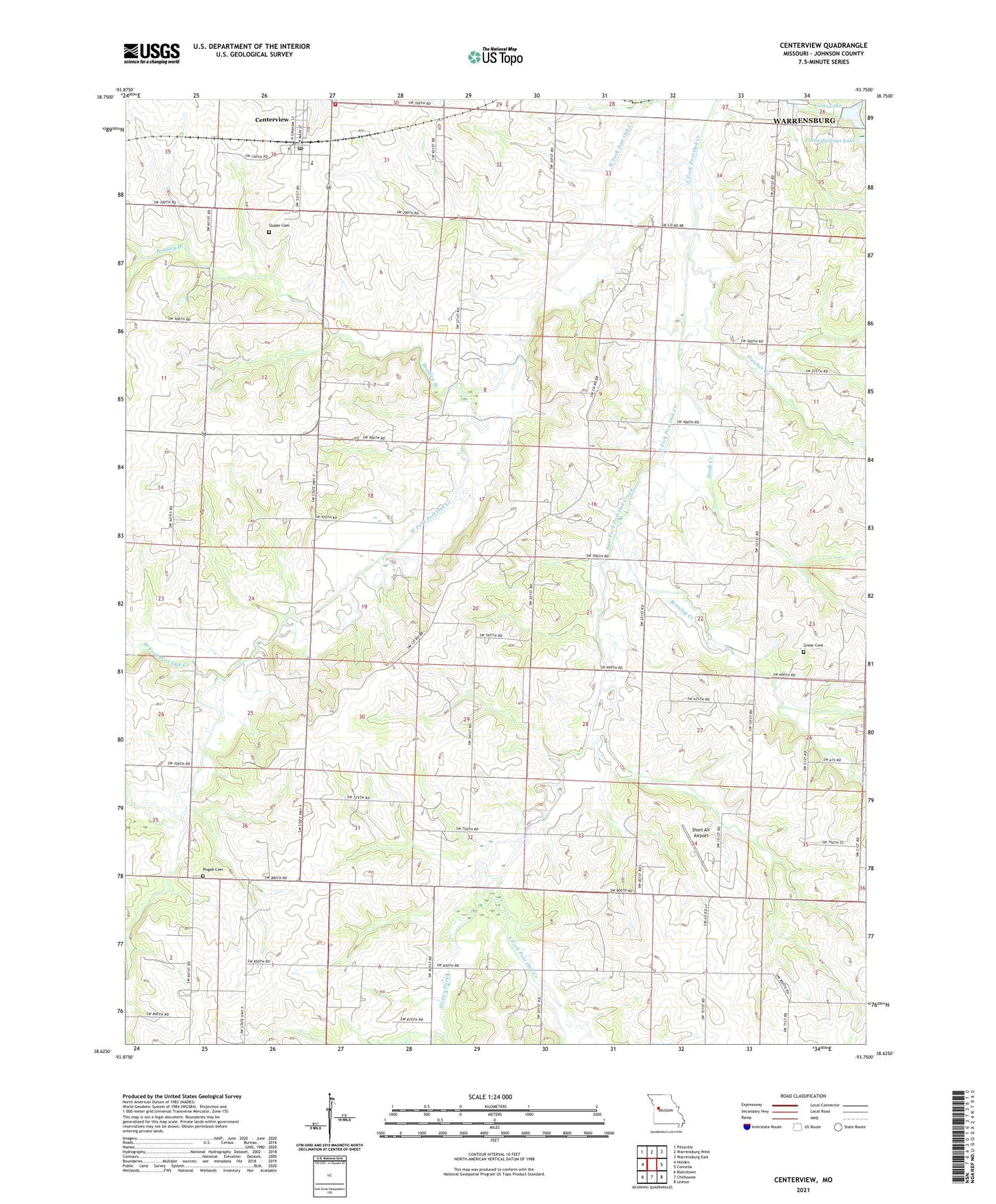
2021 topographic map quadrangle Centerview in the state of Missouri. Scale: 1:24000. Based on the newly updated USGS 7.5' US Topo map series, this map is in the following counties: Johnson. The map contains contour data, water features, and other items you are used to seeing on USGS maps, but also has updated roads and other features. This is the next generation of topographic maps. Printed on high-quality waterproof paper with UV fade-resistant inks.
Quads adjacent to this one:
West: Holden
Northwest: Pittsville
North: Warrensburg West
Northeast: Warrensburg East
East: Cornelia
Southeast: Leeton
South: Chilhowee
Southwest: Blairstown
Contains the following named places: Bradley Branch, Brawley Creek, Briscoe School, Centerview, Centerview Post Office, City of Centerview, Crest Ridge Elementary School, Easterwood Lake, Easterwood Lake Dam, Fletcher Creek, Glendale School, Greer Cemetery, Hazel Mound School, Hickory Grove School, Hogan Fork, Houts Chapel, Johnson County, Johnson County Fire Protection District Station 5 Centerview, Lions Lake, Lions Lake Dam, Locust Grove School, Masonic Hall School, Pertle Springs Dam, Pisgah Cemetery, Pleasant Valley Church, Science Hill School, Scott, Scott Post Office, Short Air Airport, Sluder Cemetery, Stoak Creek