MyTopo
Leeton Missouri US Topo Map
Couldn't load pickup availability
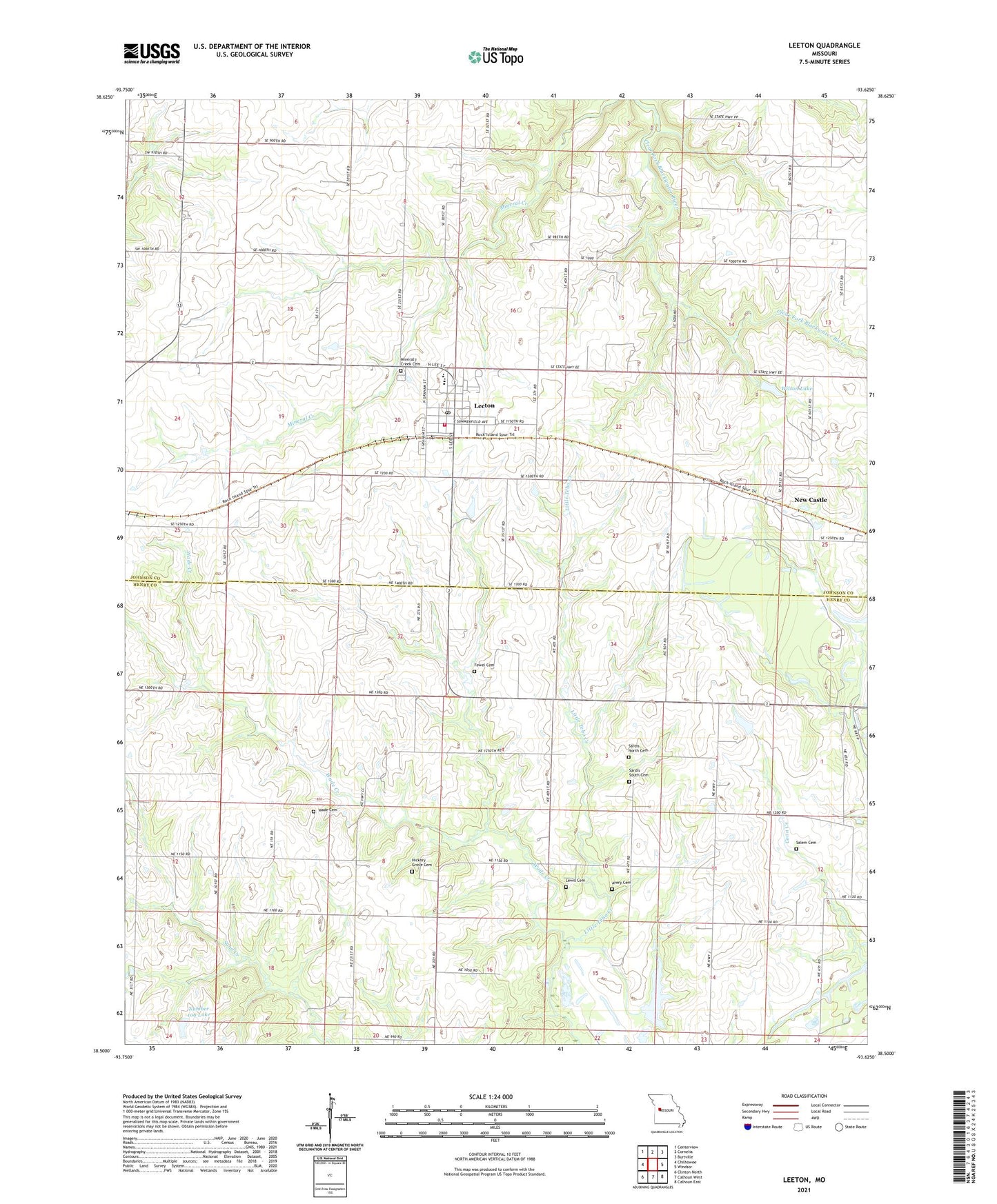
2021 topographic map quadrangle Leeton in the state of Missouri. Scale: 1:24000. Based on the newly updated USGS 7.5' US Topo map series, this map is in the following counties: Johnson, Henry. The map contains contour data, water features, and other items you are used to seeing on USGS maps, but also has updated roads and other features. This is the next generation of topographic maps. Printed on high-quality waterproof paper with UV fade-resistant inks.
Quads adjacent to this one:
West: Chilhowee
Northwest: Centerview
North: Cornelia
Northeast: Burtville
East: Windsor
Southeast: Calhoun East
South: Calhoun West
Southwest: Clinton North
This map covers the same area as the classic USGS quad with code o38093e6.
Contains the following named places: Avery Cemetery, Avery Settlement, City of Leeton, Cold Springs School, Fewel Cemetery, Gladden School, Groff Lake Dam, Hickory Grove Cemetery, Hickory Grove Church, Hickory Grove School, Johnson County Fire Protection District Station 2 Leeton, Leeton, Leeton Elementary School, Leeton High School, Leeton Middle School, Leeton Post Office, Leeton School, Lewis Cemetery, Little Tebo Creek, Lone Valley School, Mineral Creek Cemetery, Mineral Valley School, New Castle, Number 106 Lake, Number 131 Reservoir, Pleasant View School, Salem Cemetery, Sanctified Church, Sardis North Cemetery, Sardis South Cemetery, Tebo Diversionary Impoundment Dam, Township of Post Oak, Township of Tebo, Wade Cemetery, Washington School, Wilson Lake, Wilson Lake Dam, Windsor Lake Dam, ZIP Code: 64761