MyTopo
Mount Vernon Missouri US Topo Map
Couldn't load pickup availability
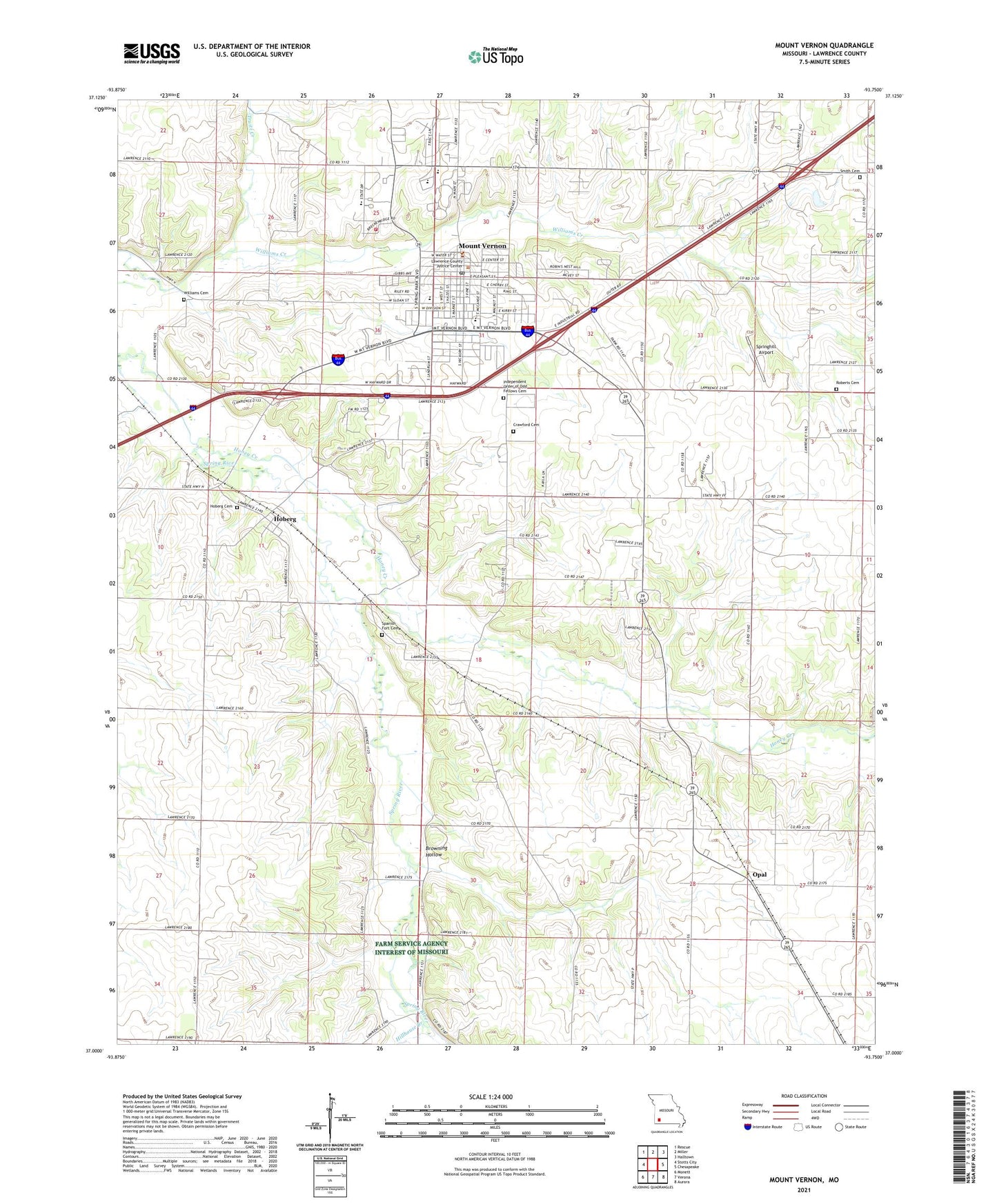
2021 topographic map quadrangle Mount Vernon in the state of Missouri. Scale: 1:24000. Based on the newly updated USGS 7.5' US Topo map series, this map is in the following counties: Lawrence. The map contains contour data, water features, and other items you are used to seeing on USGS maps, but also has updated roads and other features. This is the next generation of topographic maps. Printed on high-quality waterproof paper with UV fade-resistant inks.
Quads adjacent to this one:
West: Stotts City
Northwest: Rescue
North: Miller
Northeast: Halltown
East: Chesapeake
Southeast: Aurora
South: Verona
Southwest: Monett
This map covers the same area as the classic USGS quad with code o37093a7.
Contains the following named places: Blue Hall School, Browning Hollow, City of Mount Vernon, Crawford Cemetery, Doubling Spur, Edgewood School, Faucett Lake, Faucetts Point Lake Dam, Hillhouse Branch, Hoberg, Hoberg Cemetery, Honey Creek, Independent Order of Odd Fellows Cemetery, Kingsway Church, Lawrence County, Lawrence County Sheriff's Office, Lee School, Missouri Rehabilitation Hospital, Mount Vernon, Mount Vernon Elementary School, Mount Vernon Fire Department, Mount Vernon Golf Course, Mount Vernon High School, Mount Vernon Middle School, Mount Vernon Post Office, Mount Vernon Rural Fire Protection Association, Opal, Roberts Cemetery, Shanghai School, Skinners Spur, Smith Cemetery, Southwest Research Center Dam, Southwest Research Center Lake, Spanish Fort, Spanish Fort Cemetery, Spanish Fort School, Spring River Church, Springhill Airport, Township of Hoberg, Township of Mount Vernon, Truitt Creek, Village of Hoberg, Whitehall School, Williams Cemetery, Zion School, ZIP Code: 65712