MyTopo
Clarksburg Missouri US Topo Map
Couldn't load pickup availability
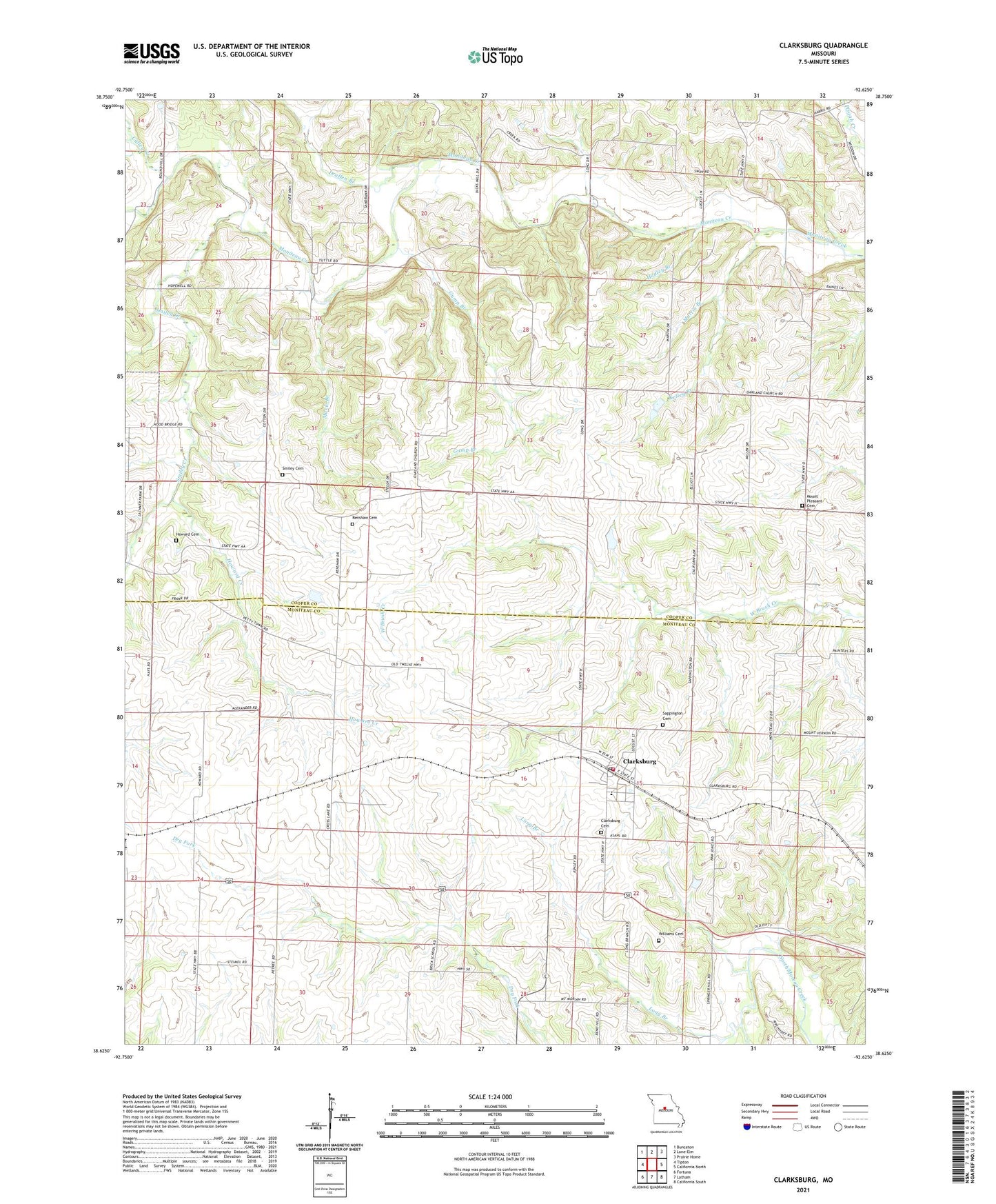
2021 topographic map quadrangle Clarksburg in the state of Missouri. Scale: 1:24000. Based on the newly updated USGS 7.5' US Topo map series, this map is in the following counties: Cooper, Moniteau. The map contains contour data, water features, and other items you are used to seeing on USGS maps, but also has updated roads and other features. This is the next generation of topographic maps. Printed on high-quality waterproof paper with UV fade-resistant inks.
Quads adjacent to this one:
West: Tipton
Northwest: Bunceton
North: Lone Elm
Northeast: Prairie Home
East: California North
Southeast: California South
South: Latham
Southwest: Fortuna
Contains the following named places: Becker-Miller-Marcum Lake Dam, City of Clarksburg, Clarksburg, Clarksburg Cemetery, Clarksburg Elementary School, Clarksburg Post Office, Clarksburg Volunteer Fire Department, Cotton, Cross Lane School, Culley Creek, Dicks Mill School, Draffen Branch, Dry Fork, Gill School, Greenwood School, Gump Branch, Hadley Branch, Howard Cemetery, Howard Creek, Keane Lake Dam, Keener School, Kelley Branch, Lakota, Long Branch, Martin Branch, Maxie Branch, Mount Moriah Church, Mount Pleasant Cemetery, Mount Pleasant Church, Mount Pleasant School, New Zion Church, North Mount Vernon School, Prairie Home School, Renshaw Cemetery, Sappington Cemetery, Smiley Cemetery, Smiley Creek, South Mount Vernon School, Township of Moreau, Township of South Moniteau, Whithinger School, Williams Cemetery, ZIP Code: 65025