MyTopo
Fortuna Missouri US Topo Map
Couldn't load pickup availability
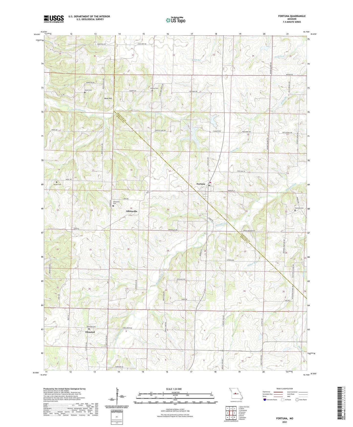
2021 topographic map quadrangle Fortuna in the state of Missouri. Scale: 1:24000. Based on the newly updated USGS 7.5' US Topo map series, this map is in the following counties: Morgan, Moniteau. The map contains contour data, water features, and other items you are used to seeing on USGS maps, but also has updated roads and other features. This is the next generation of topographic maps. Printed on high-quality waterproof paper with UV fade-resistant inks.
Quads adjacent to this one:
West: Florence
Northwest: Otterville East
North: Tipton
Northeast: Clarksburg
East: Latham
Southeast: Barnett
South: Versailles
Southwest: Stover
This map covers the same area as the classic USGS quad with code o38092e7.
Contains the following named places: Aikinsville, Aikinsville Cemetery, Allison Cemetery, Alvin, Becker School, Centennial School, Crews Lake Dam, Fortuna, Fortuna Census Designated Place, Fortuna Fire Protection District, Fortuna Post Office, Glensted, Glensted Cemetery, Glensted School, Glensted United Methodist Church, Hickory Grove School, Knipp Lake Dam, Liberty Cemetery, Newkirk Cemetery, Prairie View Church, Reno Hill, Saint Martins School, Short Fork, Stone Cemetery, Township of Willow Fork, West View School, Willow Branch, ZIP Code: 65034