MyTopo
Cyrene Missouri US Topo Map
Couldn't load pickup availability
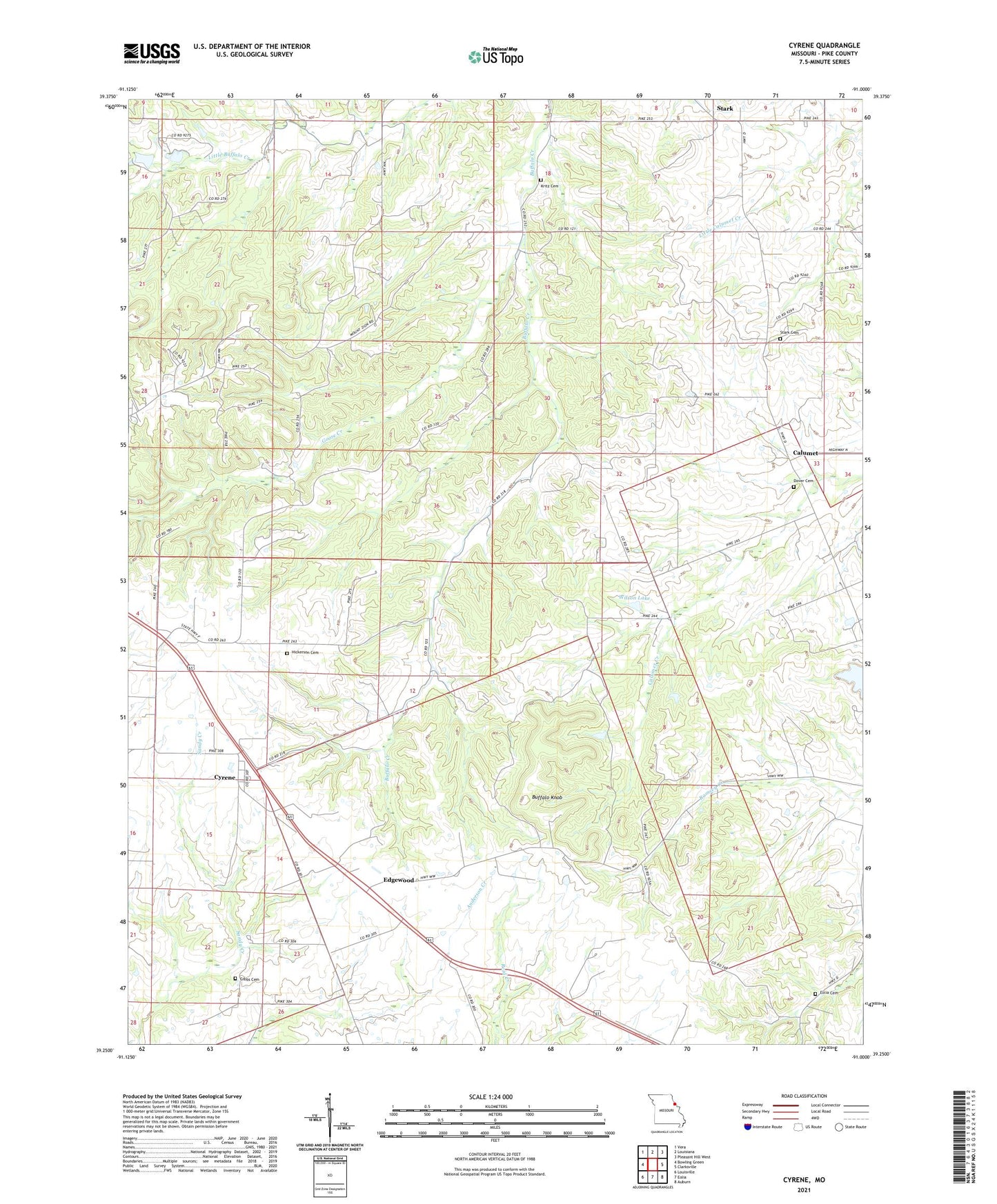
2021 topographic map quadrangle Cyrene in the state of Missouri. Scale: 1:24000. Based on the newly updated USGS 7.5' US Topo map series, this map is in the following counties: Pike. The map contains contour data, water features, and other items you are used to seeing on USGS maps, but also has updated roads and other features. This is the next generation of topographic maps. Printed on high-quality waterproof paper with UV fade-resistant inks.
Quads adjacent to this one:
West: Bowling Green
Northwest: Vera
North: Louisiana
Northeast: Pleasant Hill West
East: Clarksville
Southeast: Auburn
South: Eolia
Southwest: Louisville
Contains the following named places: Buffalo Knob, Calumet, Cyrene, Dover Cemetery, Dover Church, Eagle Point School, Edgewood, Eolia Cemetery, Gibbs Cemetery, Goose Creek, Hickerson Cemetery, J R Wilson Dam, Knob School, Kritz Cemetery, Mount Ayre Church, Mount Zion Baptist Church, Mount Zion School, Norton School, Number 150 Dam, Stark, Stark Cemetery, Township of Prairieville, Wertz Lake, Wertz Lake Dam, Wilson Lake