MyTopo
Dadeville Missouri US Topo Map
Couldn't load pickup availability
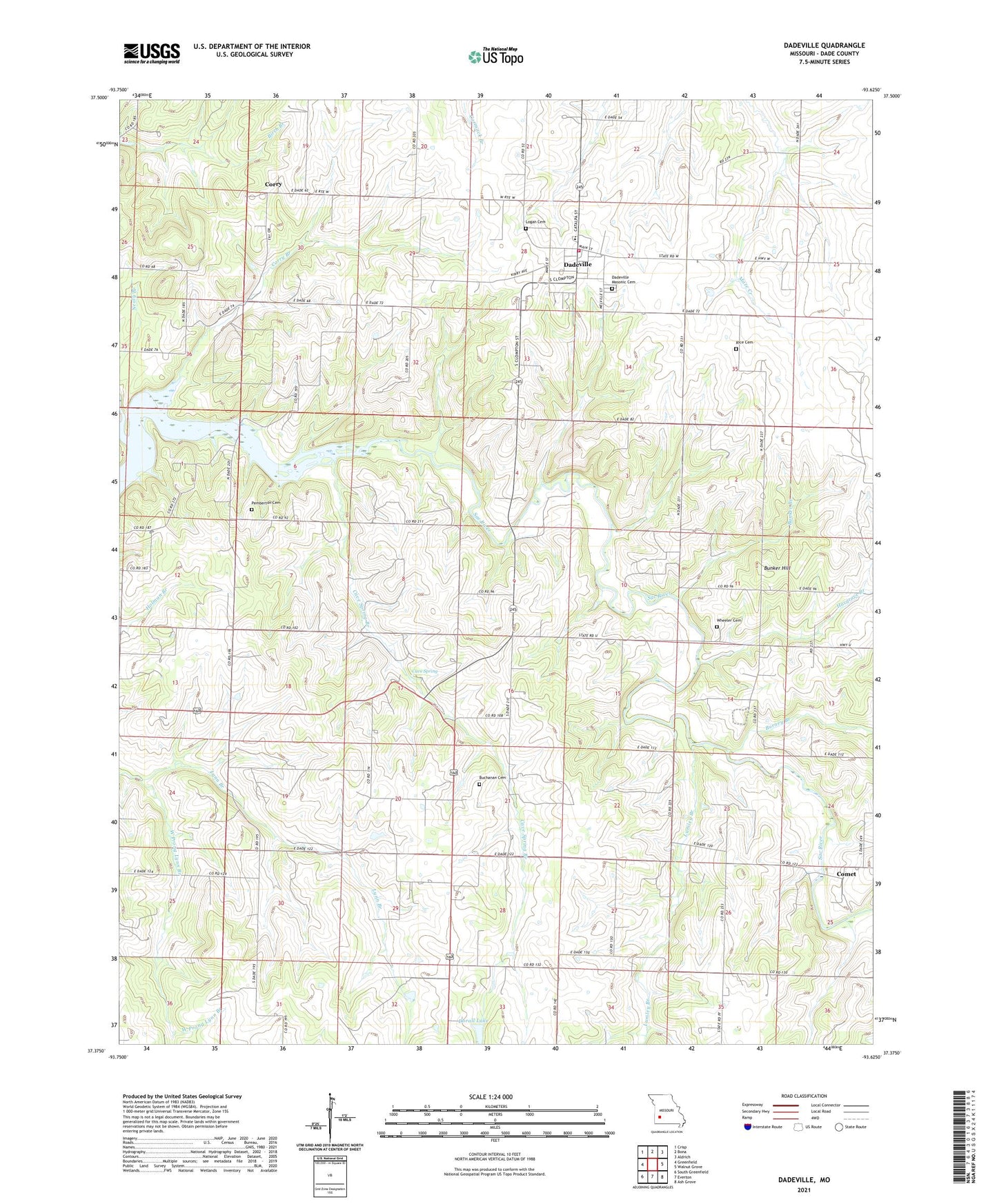
2021 topographic map quadrangle Dadeville in the state of Missouri. Scale: 1:24000. Based on the newly updated USGS 7.5' US Topo map series, this map is in the following counties: Dade. The map contains contour data, water features, and other items you are used to seeing on USGS maps, but also has updated roads and other features. This is the next generation of topographic maps. Printed on high-quality waterproof paper with UV fade-resistant inks.
Quads adjacent to this one:
West: Greenfield
Northwest: Crisp
North: Bona
Northeast: Aldrich
East: Walnut Grove
Southeast: Ash Grove
South: Everton
Southwest: South Greenfield
This map covers the same area as the classic USGS quad with code o37093d6.
Contains the following named places: Buchanan Cemetery, Bunker Branch, Bunker Hill, Burney Branch, Caseyville, Cave Spring, Cave Spring Branch, Comet, Corry, Corry Branch, Dadeville, Dadeville Elementary School, Dadeville Fire Department, Dadeville Masonic Cemetery, Dadeville Post Office, Dadeville Senior High School, Dorall Lake, Fairview Church, Giddings Lake Dam, Hampton Church, Hampton School, Hargrave Branch, Hulston, Hulston Mill, Logan Cemetery, Lumley Branch, New Hope Church, Pemberton Cemetery, Pleasant Hill Church, Pleasant Hill School, Rice Cemetery, Stockton School, Township of Polk, Township of South Morgan, Village of Dadeville, Ward, West Prong Lynn Branch, Wheeler Cemetery