MyTopo
Walnut Grove Missouri US Topo Map
Couldn't load pickup availability
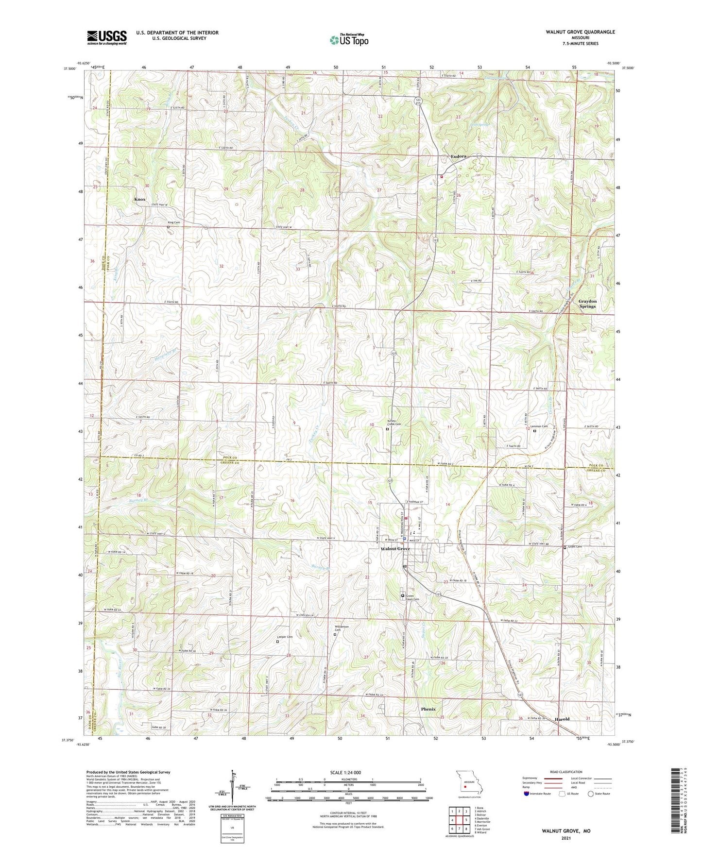
2021 topographic map quadrangle Walnut Grove in the state of Missouri. Scale: 1:24000. Based on the newly updated USGS 7.5' US Topo map series, this map is in the following counties: Polk, Greene, Dade. The map contains contour data, water features, and other items you are used to seeing on USGS maps, but also has updated roads and other features. This is the next generation of topographic maps. Printed on high-quality waterproof paper with UV fade-resistant inks.
Quads adjacent to this one:
West: Dadeville
Northwest: Bona
North: Aldrich
Northeast: Bolivar
East: Morrisville
Southeast: Willard
South: Ash Grove
Southwest: Everton
This map covers the same area as the classic USGS quad with code o37093d5.
Contains the following named places: Buckley, City of Walnut Grove, Clear Creek, Concord Church, Eudora, Eudora School, Eudora Spring, Fairview School, Flint Hill School, Graydon Springs, Green Lawn Cemetery, Harold, Harold Church, King Cemetery, King School, Knox, Leeper Cemetery, Leith Spring, Lemmon Cemetery, McBee School, Oak Grove School, Phenix, Rice School, Township of Jackson, Township of Walnut Grove, Turkey Creek Cemetery, Turkey Creek Missionary Baptist Church, Venable Spring Branch, Walnut Grove, Walnut Grove Fire Protection District Station 1, Walnut Grove Fire Protection District Station 4, Walnut Grove Police Department, Walnut Grove Post Office, Williamson Cemetery, ZIP Code: 65770