MyTopo
Darlington Missouri US Topo Map
Couldn't load pickup availability
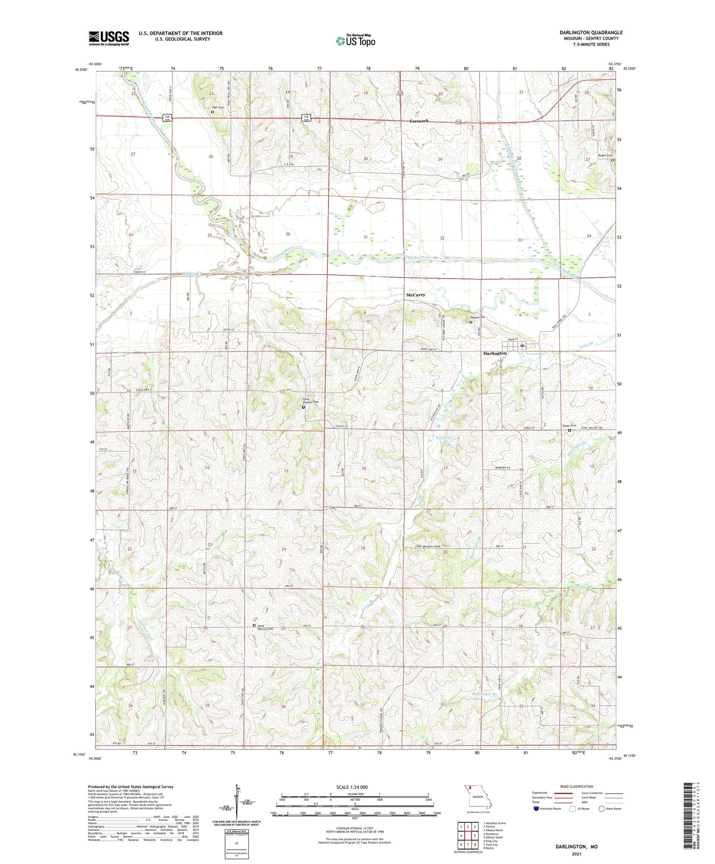
2021 topographic map quadrangle Darlington in the state of Missouri. Scale: 1:24000. Based on the newly updated USGS 7.5' US Topo map series, this map is in the following counties: Gentry. The map contains contour data, water features, and other items you are used to seeing on USGS maps, but also has updated roads and other features. This is the next generation of topographic maps. Printed on high-quality waterproof paper with UV fade-resistant inks.
Quads adjacent to this one:
West: Stanberry
Northwest: Alanthus Grove
North: Gentry
Northeast: Albany North
East: Albany South
Southeast: Berlin
South: Ford City
Southwest: King City
Contains the following named places: Buckley School, Carmack, Carmack School, Darlington, Darlington Post Office, Davis Lake Dam, East Sager School, Ettieville Lake, Gentry County, Hall Cemetery, Hammond Lake Dam, Howell School, Lindley Lake Dam, Long Branch Cemetery, Long Branch Church, McCurry, McGuire School, Middle Fork Grand River, Mount Zion Church, Rice Lake, Rodes Cemetery, Rouse Cemetery, Saint Patrick Cemetery, Sloan Cemetery, Thomas Lake Dam, Township of Cooper, Village of Darlington, Walker School, West Sager School, Wildcat Creek, ZIP Code: 64438