MyTopo
King City Missouri US Topo Map
Couldn't load pickup availability
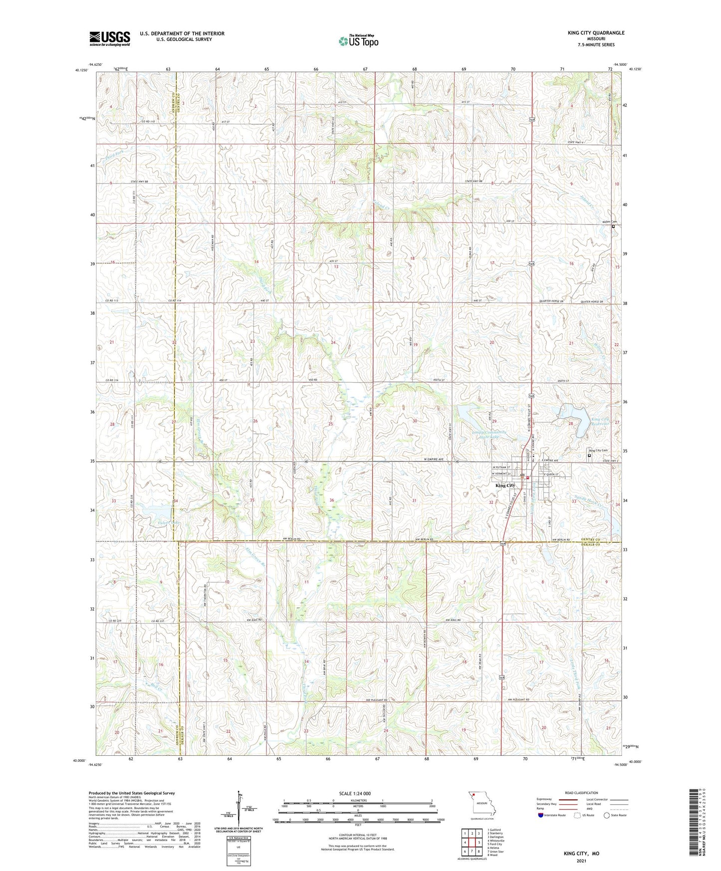
2021 topographic map quadrangle King City in the state of Missouri. Scale: 1:24000. Based on the newly updated USGS 7.5' US Topo map series, this map is in the following counties: Gentry, DeKalb, Andrew. The map contains contour data, water features, and other items you are used to seeing on USGS maps, but also has updated roads and other features. This is the next generation of topographic maps. Printed on high-quality waterproof paper with UV fade-resistant inks.
Quads adjacent to this one:
West: Whitesville
Northwest: Guilford
North: Stanberry
Northeast: Darlington
East: Ford City
Southeast: Wood
South: Union Star
Southwest: Helena
This map covers the same area as the classic USGS quad with code o40094a5.
Contains the following named places: Bray School, City of King City, Columbia School, Culver Lake, Culver Lake Dam, Douglas, Douglas Post Office, Elm Grove Branch, Fairbanks Airport, Fizzle Ridge Airport, Garfield School, Karr School, King City, King City Cemetery, King City Elementary School, King City Fire Protection District, King City High School, King City New Reservoir Dam, King City Old Reservoir Dam, King City Post Office, King City Reservoir, Limpp Community State Lake, Limpp Lake Dam, Prairie Flower School, Quad State Helicopter Heliport, Shepard School, Spiking School, Township of Jackson, Victory School