MyTopo
Deer Ridge Missouri US Topo Map
Couldn't load pickup availability
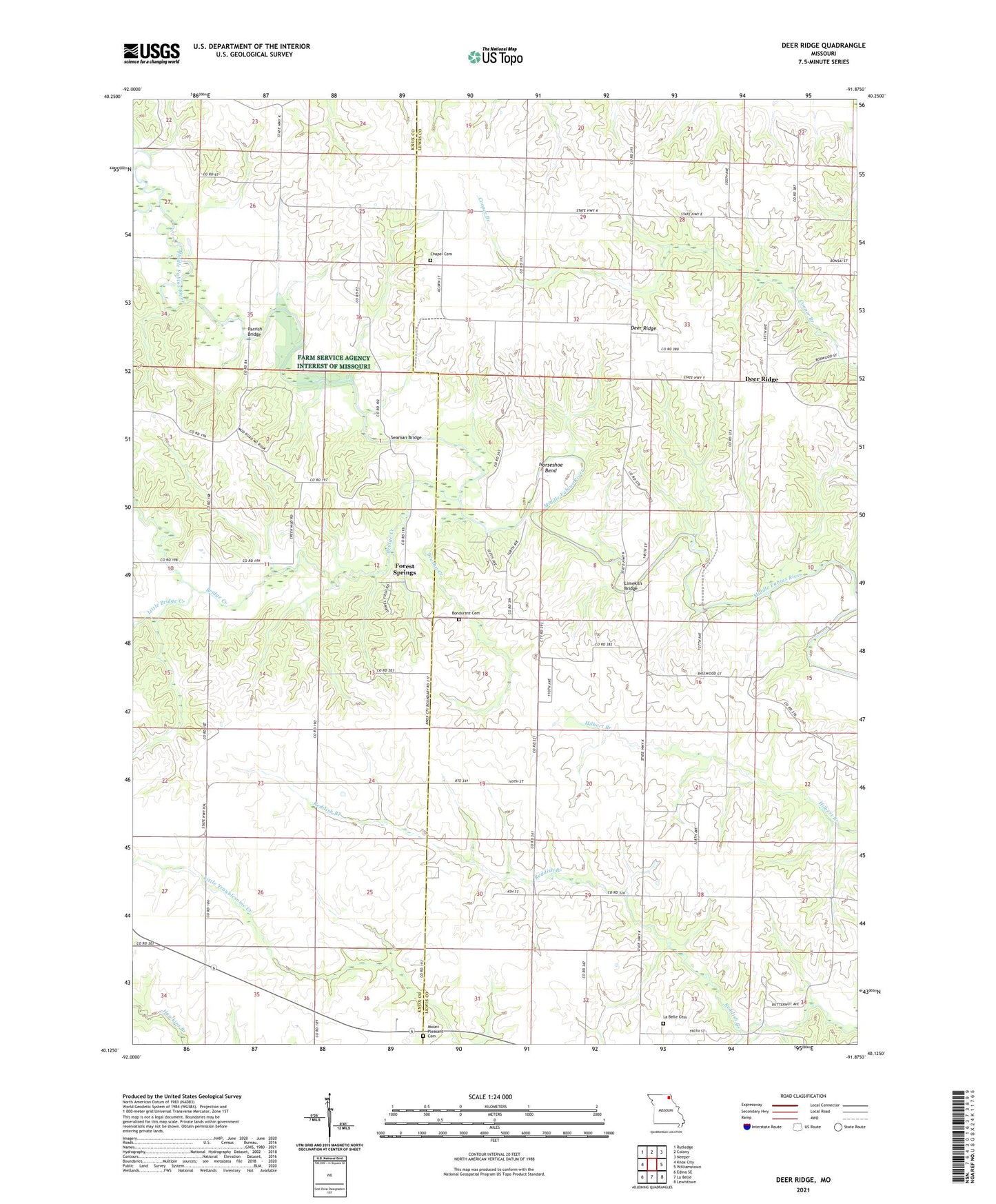
2021 topographic map quadrangle Deer Ridge in the state of Missouri. Scale: 1:24000. Based on the newly updated USGS 7.5' US Topo map series, this map is in the following counties: Lewis, Knox. The map contains contour data, water features, and other items you are used to seeing on USGS maps, but also has updated roads and other features. This is the next generation of topographic maps. Printed on high-quality waterproof paper with UV fade-resistant inks.
Quads adjacent to this one:
West: Knox City
Northwest: Rutledge
North: Colony
Northeast: Neeper
East: Williamstown
Southeast: Lewistown
South: La Belle
Southwest: Edina SE
This map covers the same area as the classic USGS quad with code o40091b8.
Contains the following named places: Banner School, Bondurant Cemetery, Bridge Creek, Brushy Creek, Chapel Cemetery, Dare School, Deer Ridge, Deer Ridge School, Fisher Branch, Forest Springs, Government School, Gregory School, Horseshoe Bend, Island School, La Belle Cemetery, Limekiln Bridge, Little Bridge Creek, Mount Pleasant Cemetery, Mount Salem Church, Parrish Bridge, Progressive School, Seaman Bridge, Sharp School, Union School, ZIP Code: 63446