MyTopo
Rutledge Missouri US Topo Map
Couldn't load pickup availability
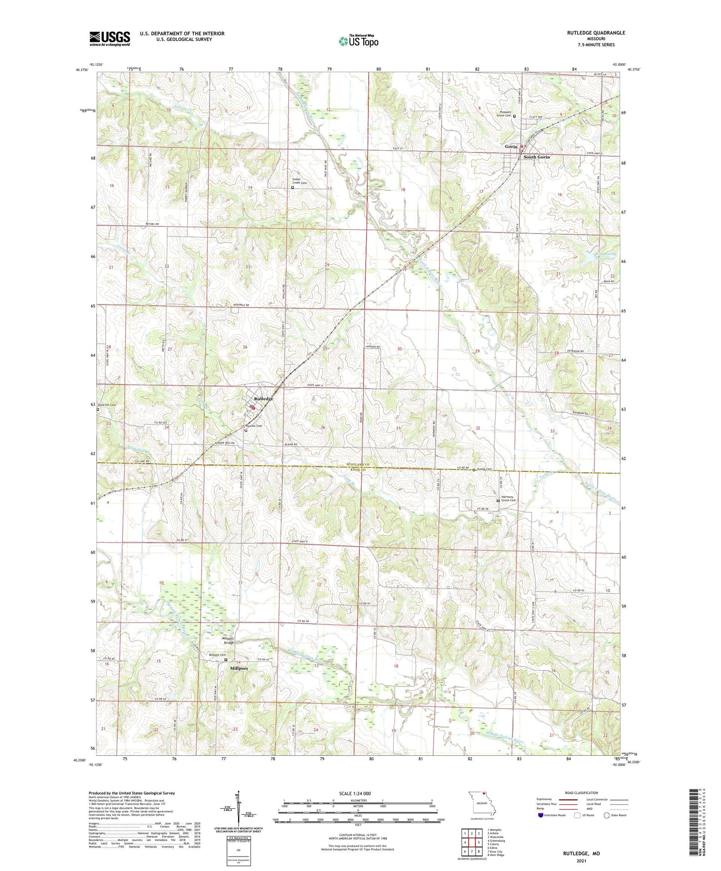
2021 topographic map quadrangle Rutledge in the state of Missouri. Scale: 1:24000. Based on the newly updated USGS 7.5' US Topo map series, this map is in the following counties: Scotland, Knox. The map contains contour data, water features, and other items you are used to seeing on USGS maps, but also has updated roads and other features. This is the next generation of topographic maps. Printed on high-quality waterproof paper with UV fade-resistant inks.
Quads adjacent to this one:
West: Greensburg
Northwest: Memphis
North: Arbela
Northeast: Wyaconda
East: Colony
Southeast: Deer Ridge
South: Knox City
Southwest: Edina
This map covers the same area as the classic USGS quad with code o40092c1.
Contains the following named places: Bear Creek Watershed B-26 Dam, Bear Creek Watershed Dam C-23, Brick School, Ella Ewing Reservoir, Ewing Cemetery, Gorin, Gorin District Volunteer Fire Department, Gorin Post Office, Harmony Grove Cemetery, Harmony Grove Church, Indian Creek, Indian Creek Baptist Church, Indian Creek Cemetery, Long Branch, Millport, Millport Bridge, Millport Cemetery, Pauline Cemetery, Pleasant Grove Cemetery, Pleasant Grove Church, Rutledge, Rutledge Community Fire Department, Rutledge Post Office, Sand Hill Branch, Sand Hill Cemetery, Sand Hill Church, Shultz Lake, Shultz Lake Dam, South Liberty School, South Mount Pleasant School, Town of Rutledge, Town of South Gorin, Township of Benton, Township of Colony, Township of Harrison, Township of Sand Hill, ZIP Codes: 63543, 63563