MyTopo
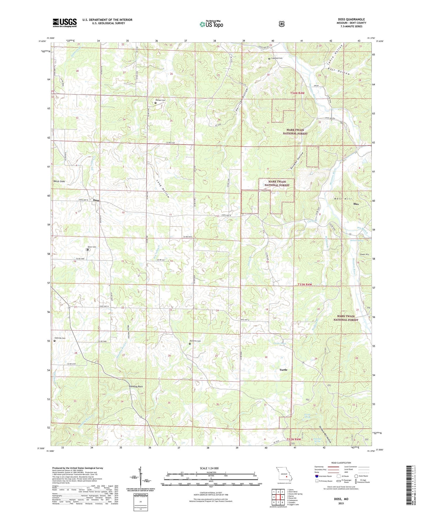
Doss Missouri US Topo Map
Couldn't load pickup availability
Also explore the Doss Forest Service Topo of this same quad for updated USFS data
2021 topographic map quadrangle Doss in the state of Missouri. Scale: 1:24000. Based on the newly updated USGS 7.5' US Topo map series, this map is in the following counties: Dent. The map contains contour data, water features, and other items you are used to seeing on USGS maps, but also has updated roads and other features. This is the next generation of topographic maps. Printed on high-quality waterproof paper with UV fade-resistant inks.
Quads adjacent to this one:
West: Darien
Northwest: Salem
North: Short Bend
Northeast: Howes Mill Spring
East: Stone Hill
Southeast: Loggers Lake
South: Gladden
Southwest: Cedargrove
This map covers the same area as the classic USGS quad with code o37091e4.
Contains the following named places: Antioch School, Antioch Spring, Ball Hill, Bell Hollow, Carty Branch, Copeland Cemetery, Doss, Douglas Hollow, Dry Branch, Fawn, Ferrill Spring, Gill School, Halbrook Cemetery, Harrison Hollow, Highland School, Long Hollow, Lynch Valley, Max, McCarter Cemetery, Metham School, Miner Cemetery, Peterball Spring, Riverside Mine, Standing Rock, Stephens Mine, Stone Hill Branch, Turtle, Turtle Pond, Turtle School, Valleyknob, Victory School, Warden Cemetery, Warfel School, Water Hollow, Welch Sinks, Wofford Branch, Young School