MyTopo
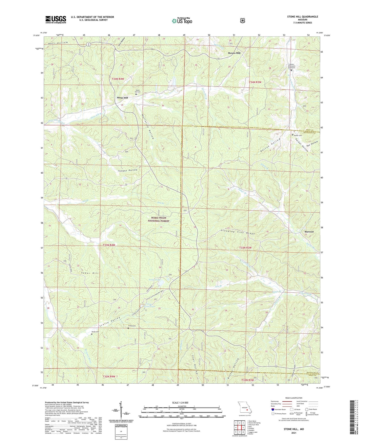
Stone Hill Missouri US Topo Map
Couldn't load pickup availability
Also explore the Stone Hill Forest Service Topo of this same quad for updated USFS data
2021 topographic map quadrangle Stone Hill in the state of Missouri. Scale: 1:24000. Based on the newly updated USGS 7.5' US Topo map series, this map is in the following counties: Dent, Reynolds. The map contains contour data, water features, and other items you are used to seeing on USGS maps, but also has updated roads and other features. This is the next generation of topographic maps. Printed on high-quality waterproof paper with UV fade-resistant inks.
Quads adjacent to this one:
West: Doss
Northwest: Short Bend
North: Howes Mill Spring
Northeast: Viburnum West
East: Greeley
Southeast: Bunker
South: Loggers Lake
Southwest: Gladden
This map covers the same area as the classic USGS quad with code o37091e3.
Contains the following named places: Bishop Dam, Brook Cemetery, Bunker Camp, Crossville School, Dalton Hollow, Hayes Branch, Howes Mill, Howes Mill Post Office, Johnson Branch, Junction Lookout, Kay Branch, Little Scotia Campground, Little Scotia Pond, MacIntire Hollow, Marcoot, Marcoot Lookout, Marcoot School, Nelson Branch, Nelson School, Nelson Schoolyard Graveyard, Ozark Foothills Planning Region, Parker Cemetery, Parker Hollow, Rye Hollow, Scotia Cemetery, Scotia Demonstration Area, Scotia Iron Mine, Scotia Pond, Scotia Pond Dam, Scotia Valley, Stone Hill, Stone Hill Cemetery, Stone Hill Church, Stone Hill School, Stooping Tree Ridge, Teague Hollow, Tower Hill, Township of Linn