MyTopo
Dudenville Missouri US Topo Map
Couldn't load pickup availability
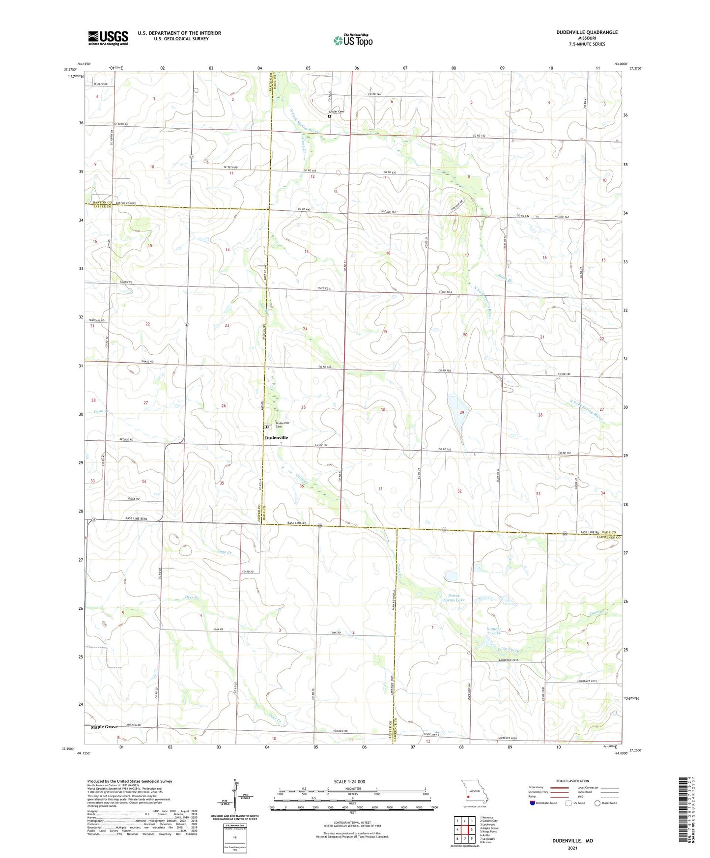
2021 topographic map quadrangle Dudenville in the state of Missouri. Scale: 1:24000. Based on the newly updated USGS 7.5' US Topo map series, this map is in the following counties: Dade, Jasper, Lawrence, Barton. The map contains contour data, water features, and other items you are used to seeing on USGS maps, but also has updated roads and other features. This is the next generation of topographic maps. Printed on high-quality waterproof paper with UV fade-resistant inks.
Quads adjacent to this one:
West: Maple Grove
Northwest: Kenoma
North: Golden City
Northeast: Lockwood
East: Kings Point
Southeast: Rescue
South: La Russell
Southwest: Avilla
Contains the following named places: Ackley School, Bowman School, Coon Creek, Davis Lake Dam, Dudenville, Fairview School, Harlan Stump Dam, Kistler Cemetery, Leaming Field, Number 71 Lake, Pleasant View School, Poirot Farms Incorporated Dam, Poirot Farms Lake, Poirot Lake Dam Shallow Dam, Prairie Home School, Pyle Lake Dam, Sams Branch, Schilling Lake, Schilling Lake Dam, Sharon School, Snowflake School, Townley Lake, Townley Lake Dam, Township of Grant, Township of Lincoln, Unity School, Victory Community Center, ZIP Code: 64748