MyTopo
Rescue Missouri US Topo Map
Couldn't load pickup availability
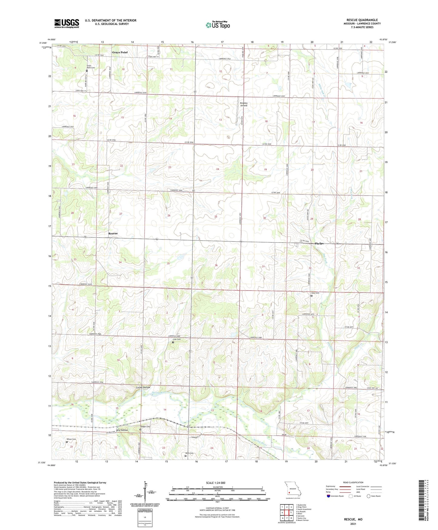
2021 topographic map quadrangle Rescue in the state of Missouri. Scale: 1:24000. Based on the newly updated USGS 7.5' US Topo map series, this map is in the following counties: Lawrence. The map contains contour data, water features, and other items you are used to seeing on USGS maps, but also has updated roads and other features. This is the next generation of topographic maps. Printed on high-quality waterproof paper with UV fade-resistant inks.
Quads adjacent to this one:
West: La Russell
Northwest: Dudenville
North: Kings Point
Northeast: South Greenfield
East: Miller
Southeast: Mount Vernon
South: Stotts City
Southwest: Sarcoxie
This map covers the same area as the classic USGS quad with code o37093b8.
Contains the following named places: Ash Grove School, Beck Cemetery, Beck School, Cole Cemetery, Colley Hollow, Dry Fork, Dry Hollow, Gaither, Goss Cemetery, Grays Point, Grays Point Cemetery, Hodges Cemetery, Jackson School, Kingsley Airfield, Northfield School, Phelps, Phelps School, Rescue, Scotts School, Shaffer School, Stahl Creek, Star School, Stone Chapel, Stotts City, Township of Green, Township of Vineyard, Unionjoy School, West School, Wilson Cemetery, ZIP Code: 64848