MyTopo
La Russell Missouri US Topo Map
Couldn't load pickup availability
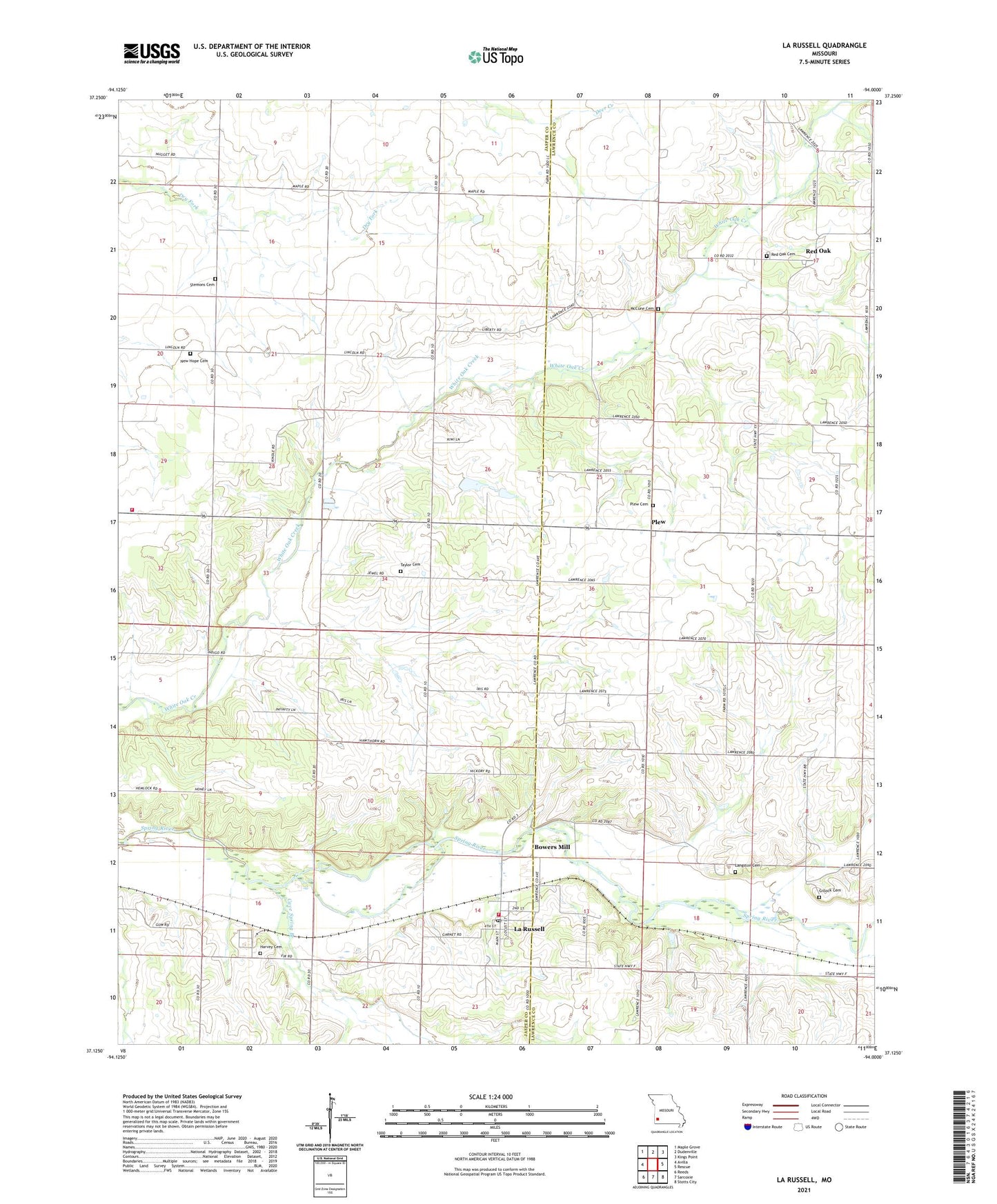
2021 topographic map quadrangle La Russell in the state of Missouri. Scale: 1:24000. Based on the newly updated USGS 7.5' US Topo map series, this map is in the following counties: Jasper, Lawrence. The map contains contour data, water features, and other items you are used to seeing on USGS maps, but also has updated roads and other features. This is the next generation of topographic maps. Printed on high-quality waterproof paper with UV fade-resistant inks.
Quads adjacent to this one:
West: Avilla
Northwest: Maple Grove
North: Dudenville
Northeast: Kings Point
East: Rescue
Southeast: Stotts City
South: Sarcoxie
Southwest: Reeds
This map covers the same area as the classic USGS quad with code o37094b1.
Contains the following named places: Avilla Volunteer Fire Department Station 1, Avilla Volunteer Fire Department Station 2, Blake Church, Blake School, Bois D'Arc School, Bowers Mill, Bowers Mill School, Cave Spring Branch, Cherry Grove School, City of La Russell, Fairview School, Fellowship Church, Gillock Cemetery, Harvey Cemetery, Henry School, La Russell, La Russell Post Office, La Russell School, Langston Cemetery, McCune Cemetery, New Hope Cemetery, New Hope Church, New Hope School, Plew, Plew Church, Red Oak, Red Oak School, Rusk School, Stemons Cemetery, Taylor Cemetery, Township of McDonald, Township of Red Oak, White Oak Church