MyTopo
El Dorado Springs North Missouri US Topo Map
Couldn't load pickup availability
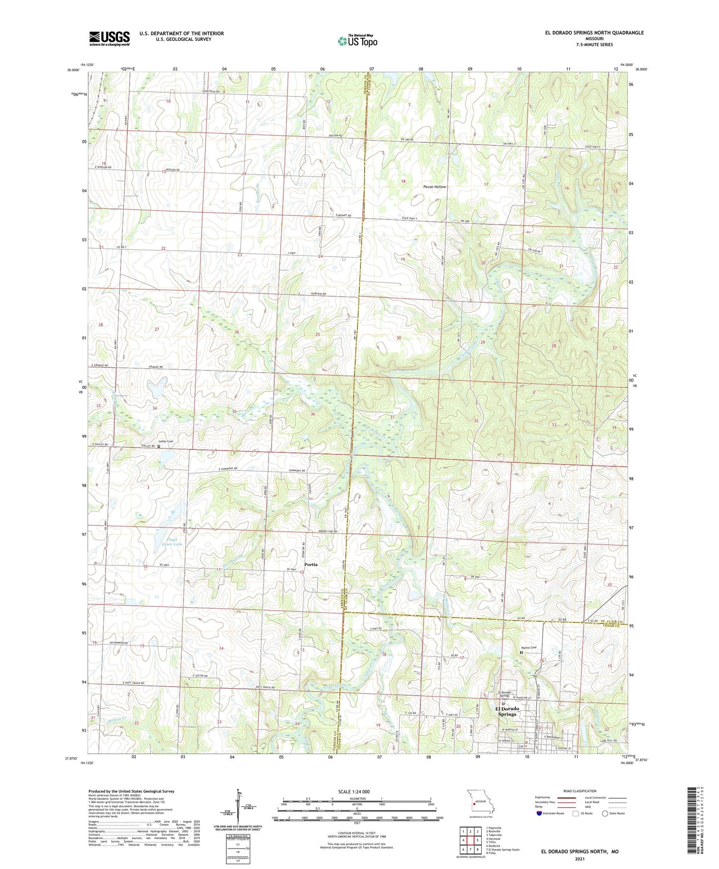
2021 topographic map quadrangle El Dorado Springs North in the state of Missouri. Scale: 1:24000. Based on the newly updated USGS 7.5' US Topo map series, this map is in the following counties: St. Clair, Vernon, Cedar. The map contains contour data, water features, and other items you are used to seeing on USGS maps, but also has updated roads and other features. This is the next generation of topographic maps. Printed on high-quality waterproof paper with UV fade-resistant inks.
Quads adjacent to this one:
West: Harwood
Northwest: Papinville
North: Rockville
Northeast: Taberville
East: Tiffin
Southeast: Filley
South: El Dorado Springs South
Southwest: Dederick
Contains the following named places: Beard Lake Dam, Beecham Branch, Camp Galilee, Donia, Donia Post Office, El Dorado Springs, El Dorado Springs Cemetery, El Dorado Springs City Park, Floyd Hines Dam, Floyd Hines Lake, Fly Creek, Forest Grove School, Hines Lake Section 10 Dam, Hines Section 3 North Dam, Hines Section 3 South Lake Dam, Jackson School, Joes Branch, Kitten Creek, Lefler Cemetery, Lefler School, Liston School, Martin Cemetery, McCord Branch, Oak Grove Church, Oak Ridge School, Pleasant Grove Church, Portia, Prairie Valley School, Roberts School, Stony Point School, Township of Bacon, Township of Clear Creek, Township of West Speedwell, Union School, Walnut Creek, West Eldorado, ZIP Code: 64750