MyTopo
Eldridge East Missouri US Topo Map
Couldn't load pickup availability
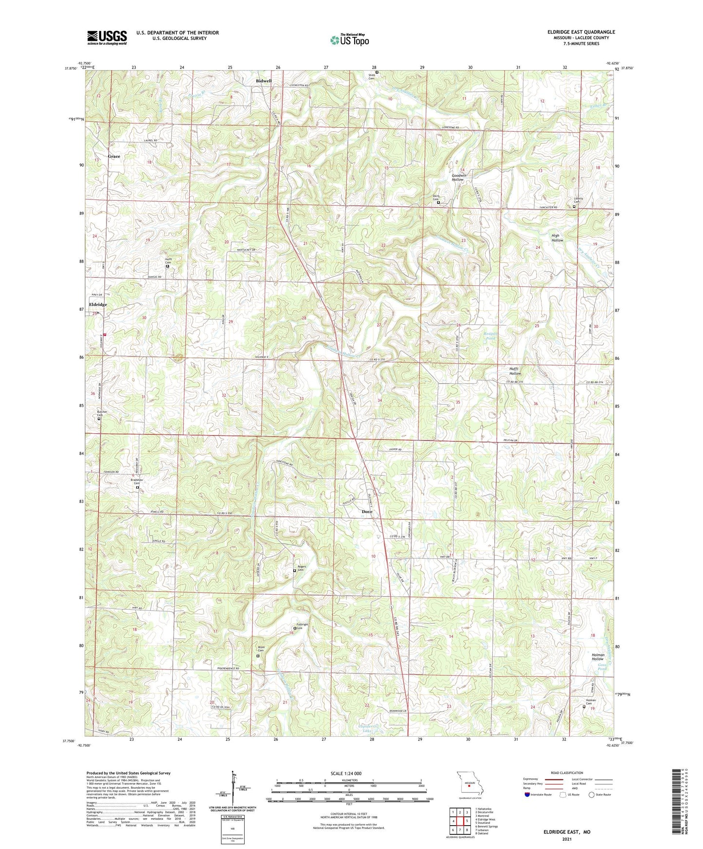
2021 topographic map quadrangle Eldridge East in the state of Missouri. Scale: 1:24000. Based on the newly updated USGS 7.5' US Topo map series, this map is in the following counties: Laclede. The map contains contour data, water features, and other items you are used to seeing on USGS maps, but also has updated roads and other features. This is the next generation of topographic maps. Printed on high-quality waterproof paper with UV fade-resistant inks.
Quads adjacent to this one:
West: Eldridge West
Northwest: Hahatonka
North: Decaturville
Northeast: Montreal
East: Stoutland
Southeast: Oakland
South: Lebanon
Southwest: Bennett Springs
This map covers the same area as the classic USGS quad with code o37092g6.
Contains the following named places: Alexander School, Bidwell, Bradshaw Cemetery, Butcher Cemetery, Capoferri Lake, Capoferri Lake Dam, Davis Cemetery, Dove, Dove Church, Dryglaize, Eldridge, Eldridge Post Office, Eldridge Volunteer Fire Department, Esther Branch, Friendship Church, Friendship School, Fulbright Cemetery, Goodwin Calvary Church, Goodwin Hollow, Goodwin Hollow Creek, Goodwin School, Goss Pond, Grace, High Hollow, Holman Cemetery, Holman Hollow, Hufft Cemetery, Hufft Hollow, Keener School, KIRK-FM (Lebanon), Liberty Church, Merchant School, Mizer Cemetery, North Liberty Cemetery, Reagan Church, Reagan Pond, Reagan School, Rogers - Allison - Davis Cemetery, Shith Cemetery, Township of Auglaize, Zion Church, Zion School