MyTopo
Stoutland Missouri US Topo Map
Couldn't load pickup availability
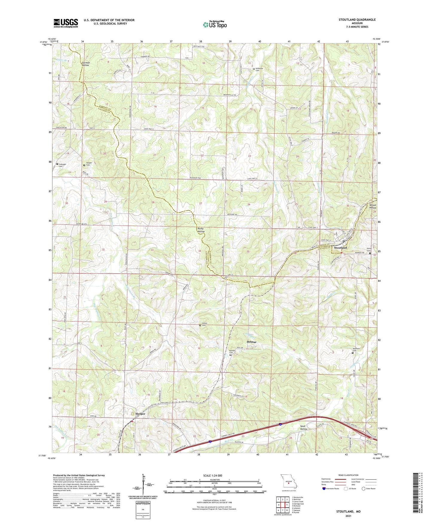
2021 topographic map quadrangle Stoutland in the state of Missouri. Scale: 1:24000. Based on the newly updated USGS 7.5' US Topo map series, this map is in the following counties: Laclede, Camden. The map contains contour data, water features, and other items you are used to seeing on USGS maps, but also has updated roads and other features. This is the next generation of topographic maps. Printed on high-quality waterproof paper with UV fade-resistant inks.
Quads adjacent to this one:
West: Eldridge East
Northwest: Decaturville
North: Montreal
Northeast: Conns Creek
East: Richland
Southeast: Drynob
South: Oakland
Southwest: Lebanon
This map covers the same area as the classic USGS quad with code o37092g5.
Contains the following named places: Barnett Cemetery, Braddock School, City of Stoutland, Cox Crossing School, Deberry, Delmar, Fulbright Cemetery, Greenstreet School, Hickory Grove School, Hillhouse Cemetery, Honey Cemetery, Hooper Cemetery, Jordan Creek, Lomax Cemetery, Mayfield Cemetery, Pleasant Grove Church, Pritchett School, Sleeper, Sleeper Volunteer Fire Department, Spud Hollow, Stoutland, Stoutland Post Office, Stoutland Volunteer Fire Department, Turner School, Williamson Branch, ZIP Code: 65567