MyTopo
Ellington SE Missouri US Topo Map
Couldn't load pickup availability
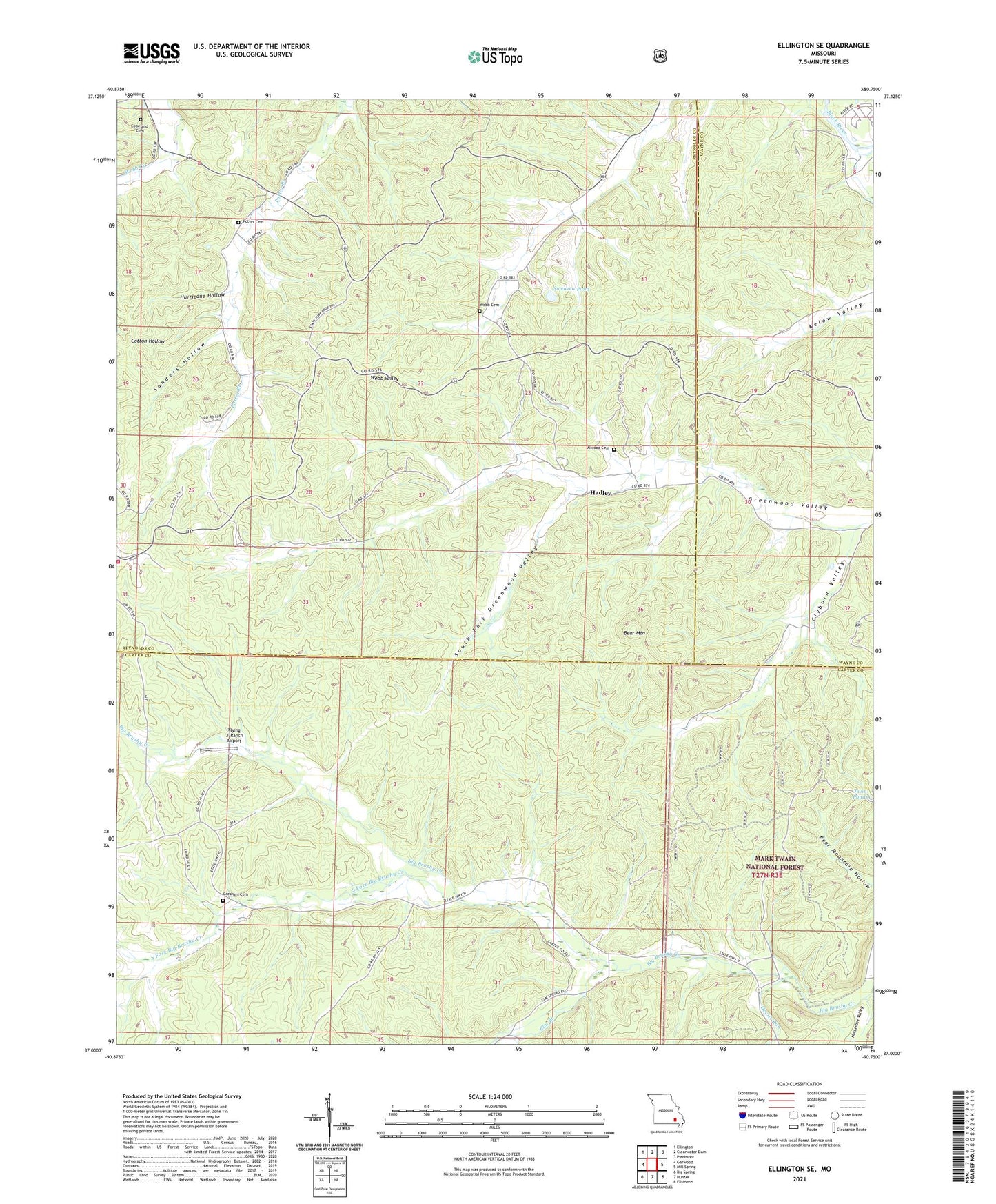
2021 topographic map quadrangle Ellington SE in the state of Missouri. Scale: 1:24000. Based on the newly updated USGS 7.5' US Topo map series, this map is in the following counties: Carter, Reynolds, Wayne. The map contains contour data, water features, and other items you are used to seeing on USGS maps, but also has updated roads and other features. This is the next generation of topographic maps. Printed on high-quality waterproof paper with UV fade-resistant inks.
Quads adjacent to this one:
West: Garwood
Northwest: Ellington
North: Clearwater Dam
Northeast: Piedmont
East: Mill Spring
Southeast: Ellsinore
South: Hunter
Southwest: Big Spring
Contains the following named places: Alwood Cemetery, Bear Mountain, Chilton, Clyburn Valley, Copeland Cemetery, Devils Kitchen Mine, Devils Run, Devils Run School, Dry Hill Church, Dry Hill School, Duncan, Elm Branch, Elm Branch School, Flying 'J' Ranch Airport, Free Union Church, Garwood Volunteer Fire Department, Hadley, Hurricane Hollow, Oak Grove Church, Oak Grove School, Oak Spring Branch, Potter Cemetery, Roland Church, Roland School, Sanders Hollow, South Fork Big Brushy Creek, South Fork Greenwood Valley, Sweazea Pond, Twin Ponds, Webb Cemetery