MyTopo
Big Spring Missouri US Topo Map
Couldn't load pickup availability
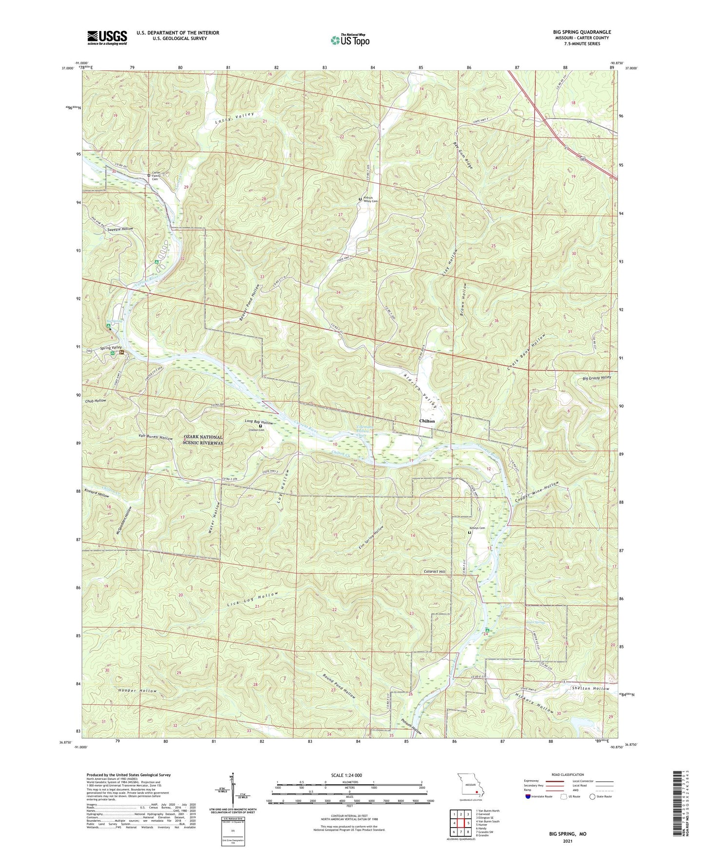
2021 topographic map quadrangle Big Spring in the state of Missouri. Scale: 1:24000. Based on the newly updated USGS 7.5' US Topo map series, this map is in the following counties: Carter. The map contains contour data, water features, and other items you are used to seeing on USGS maps, but also has updated roads and other features. This is the next generation of topographic maps. Printed on high-quality waterproof paper with UV fade-resistant inks.
Quads adjacent to this one:
West: Van Buren South
Northwest: Van Buren North
North: Garwood
Northeast: Ellington SE
East: Hunter
Southeast: Grandin
South: Grandin SW
Southwest: Handy
This map covers the same area as the classic USGS quad with code o36090h8.
Contains the following named places: Aldrich Valley, Aldrich Valley Cemetery, Aldrich Valley School, Beaver Pond Hollow, Bee Gum Ridge, Big Grassy Valley, Big Spring, Big Spring Campgrounds, Big Spring River Access, Big Spring State Park, Brown Hollow, Carter County, Carter Creek, Cataract Hill, Cataract Landing, Cave Spring, CCC Historic District, Chalk Bank Hollow, Chilton, Chilton Cemetery, Chilton Creek, Chub Hollow, Clay Hollow, Club House, Colemans Failure Chute, Copper Mine Hollow, Elm Spring Hollow, Hickory Church, Hickory Hollow, Hickory Landing, Kelleys Cemetery, Kinnard Hollow, Latty Valley, Lick Log Hollow, Log Hollow, Long Bay, Long Bay Hollow, McSpadden Hollow, Possum Hollow, Round Pond Hollow, Shelton Hollow, Short, Spring Valley, Sweezie Hollow, Van Buren Hollow, Water Hollow