MyTopo
Garwood Missouri US Topo Map
Couldn't load pickup availability
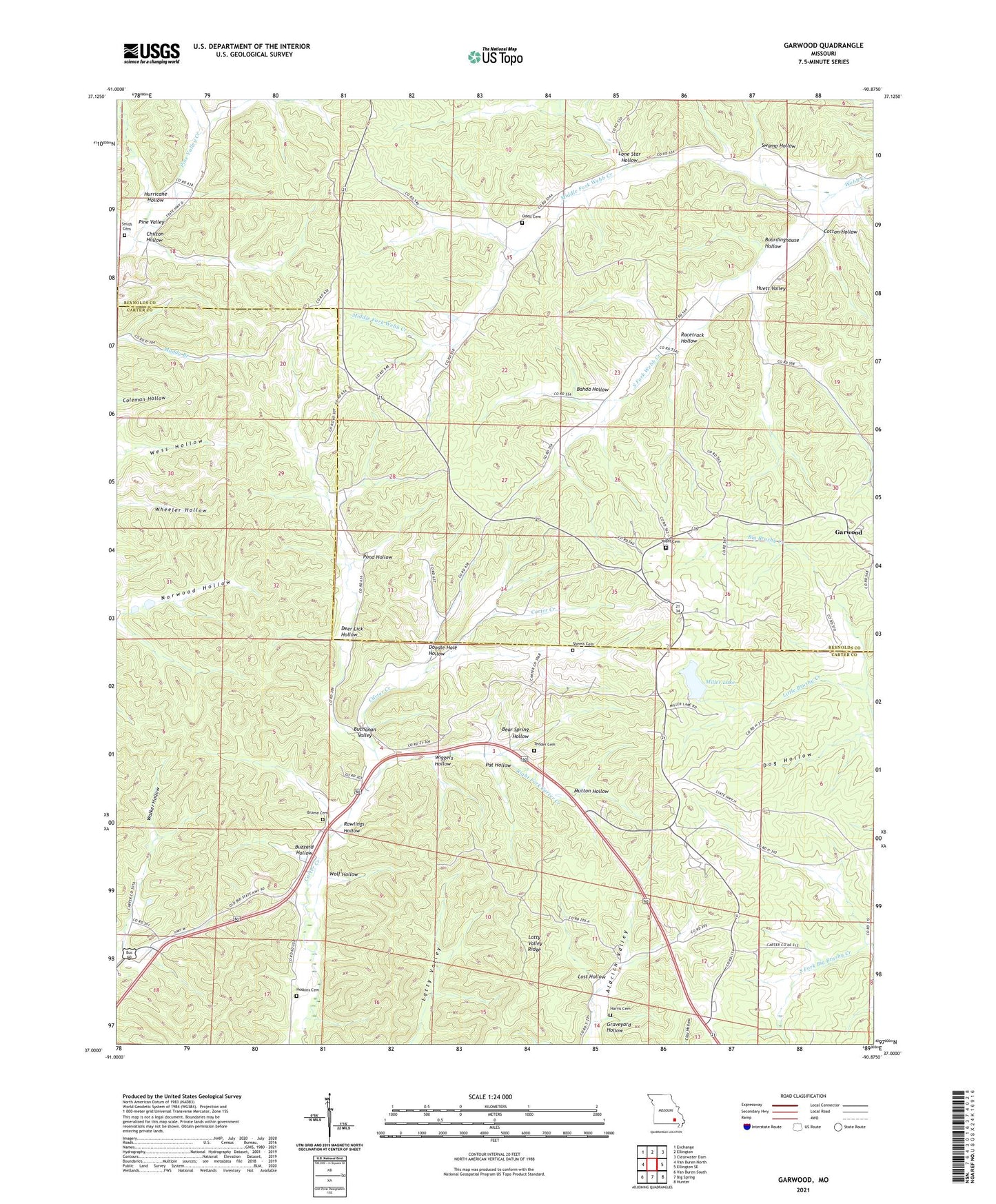
2021 topographic map quadrangle Garwood in the state of Missouri. Scale: 1:24000. Based on the newly updated USGS 7.5' US Topo map series, this map is in the following counties: Carter, Reynolds. The map contains contour data, water features, and other items you are used to seeing on USGS maps, but also has updated roads and other features. This is the next generation of topographic maps. Printed on high-quality waterproof paper with UV fade-resistant inks.
Quads adjacent to this one:
West: Van Buren North
Northwest: Exchange
North: Ellington
Northeast: Clearwater Dam
East: Ellington SE
Southeast: Hunter
South: Big Spring
Southwest: Van Buren South
This map covers the same area as the classic USGS quad with code o37090a8.
Contains the following named places: Bahda Hollow, Bear Spring Hollow, Boardinghouse Hollow, Brame, Brame Cemetery, Buchanan Valley, Buzzard Hollow, Carter Creek School, Chilton Hollow, Cotton Hollow, Deer Lick Hollow, Dog Hollow, Doodle Hole Hollow, Fairview School, Garwood, Garwood Lookout Tower, Graveyard Hollow, Harris Cemetery, Hill and Dale East Dam, Hill and Dale West Dam, Hoskins Cemetery, Huett Valley, Hurricane Hollow, Keeney Corner, Latty Valley Ridge, Liberty Church, Little Brushy Creek, Lone Star Hollow, Lost Hollow, Merrill Lake Dam, Middle Fork Webb Creek, Miller Community Lake State Wildlife Area, Miller Lake, Mutton Hollow, Number 50 Dam, Number 50 Lake, Odell Cemetery, Pat Hollow, Pine Valley, Pond Hollow, Racetrack Hollow, Rawlings Hollow, Right Fork Carter Creek, Sheets Cemetery, Smith Cemetery, South Fork Webb Creek, Swamp Hollow, Tedder Cemetery, Victory School, Webb Creek State Forest, Wiggers Hollow, Wolf Hollow, Yount Church