MyTopo
Eminence Missouri US Topo Map
Couldn't load pickup availability
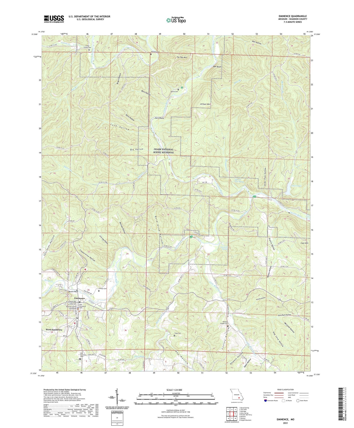
2021 topographic map quadrangle Eminence in the state of Missouri. Scale: 1:24000. Based on the newly updated USGS 7.5' US Topo map series, this map is in the following counties: Shannon. The map contains contour data, water features, and other items you are used to seeing on USGS maps, but also has updated roads and other features. This is the next generation of topographic maps. Printed on high-quality waterproof paper with UV fade-resistant inks.
Quads adjacent to this one:
West: Alley Spring
Northwest: Round Spring
North: The Sinks
Northeast: Midridge
East: Powder Mill Ferry
Southeast: Stegall Mountain
South: Winona
Southwest: Bartlett
Contains the following named places: Asher Branch, Bald Knob Hollow, Barn Hollow, Bay Branch, Bee Bluff, Bee Bluff School, Bethany Chapel, Big Creek, Bunch Cemetery, Buttin Rock, Cave Hollow, Cedar Pole Hollow, Chilton Cemetery, City of Eminence, Colwil Dam, Colwil Lake, Conley Hollow, Coot Chute, Coot Mountain, Coppermine Hollow, Dark Hollow, De Weese School, Despain Hollow, Dry Hollow, Dugan Hollow, Ebb and Flow Spring, Eminence, Eminence Lookout Tower, Eminence Post Office, Eminence Rural Fire Department, Fursman Spring, Grassy Creek, Hay Hollow, Hog Cave Hollow, Jacks Fork, Jerktail Landing, Jerktail Mountain, Junction Ferry, Kelsaw Hollow, Lick Log Hollow, Little Shawnee Creek, Little Shawnee School, Lower Grassy Cemetery, Matthews Branch, McCabe Hollow, Mill Hollow, Missouri Department of Conservation District Forester Office, Missouri Department of Conservation Forestry Ozark Regional Field Fire Facility Office Eminence, New Eminence Cemetery, Nichols Hollow, Odell Hollow, Prairie Hollow, Prairie Hollow School, Saint Sylvester Church, Shannon County Sheriff's Office, Shawnee Creek, Shawnee Creek Campsite, Slater Spring, Slick Rock Hollow, Storys Creek, Sutton Creek, Sutton Creek School, Thompson Creek, Tip Top Mountain, Township of Buckeye, Township of Eminence, Twin Rocks, Two Rivers River Access, Werfield Hollow, West Eminence, Williams Cemetery, ZIP Code: 65466