MyTopo
The Sinks Missouri US Topo Map
Couldn't load pickup availability
Also explore the The Sinks Forest Service Topo of this same quad for updated USFS data
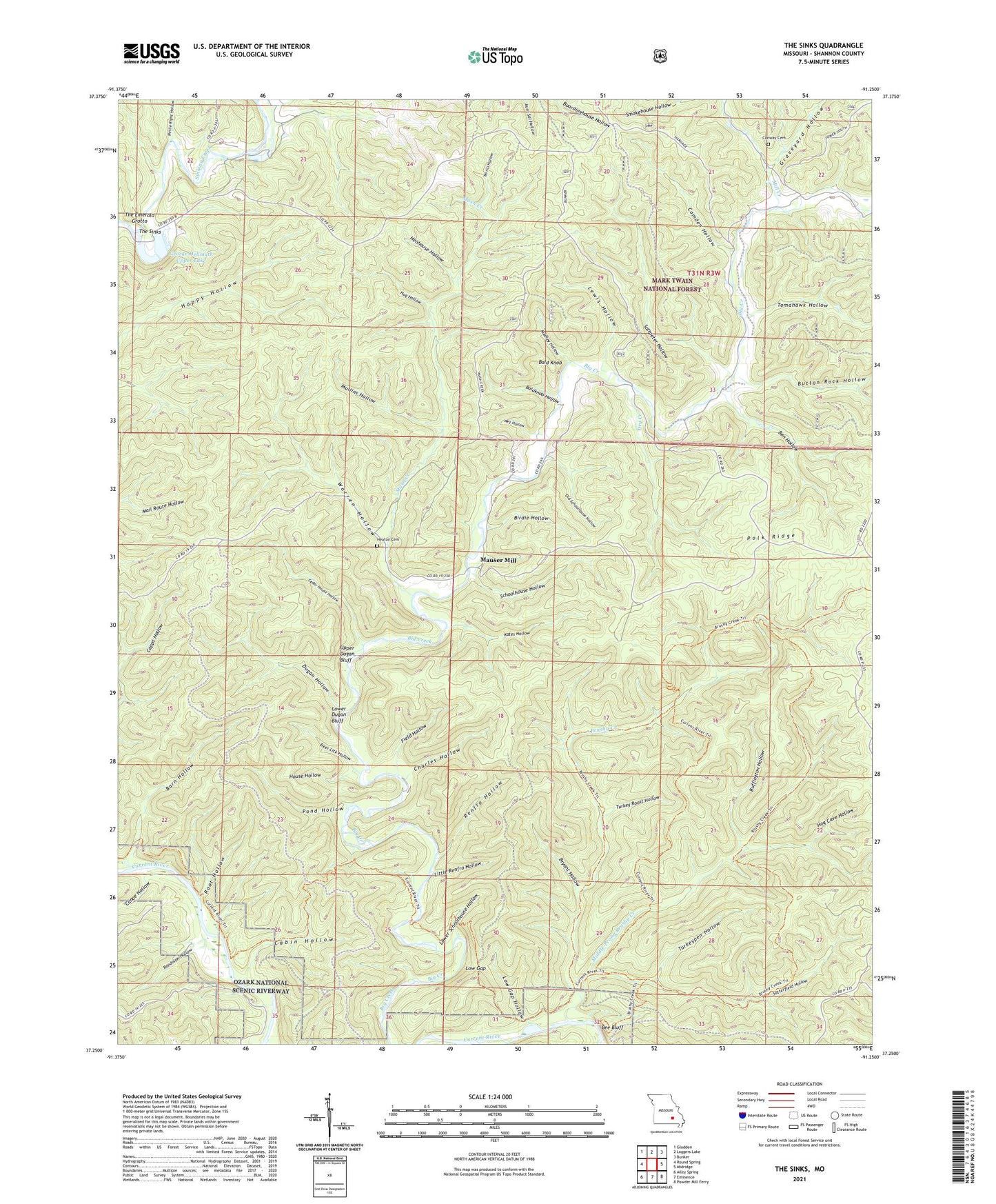
2021 topographic map quadrangle The Sinks in the state of Missouri. Scale: 1:24000. Based on the newly updated USGS 7.5' US Topo map series, this map is in the following counties: Shannon. The map contains contour data, water features, and other items you are used to seeing on USGS maps, but also has updated roads and other features. This is the next generation of topographic maps. Printed on high-quality waterproof paper with UV fade-resistant inks.
Quads adjacent to this one:
West: Round Spring
Northwest: Gladden
North: Loggers Lake
Northeast: Bunker
East: Midridge
Southeast: Powder Mill Ferry
South: Eminence
Southwest: Alley Spring
This map covers the same area as the classic USGS quad with code o37091c3.
Contains the following named places: Bald Knob, Baldknob Hollow, Barn Hollow, Bee Bluff, Ben Hollow, Big Creek School, Birdie Hollow, Brushy Creek, Brushy Mill, Brushy Post Office, Bryant Hollow, Buffington Hollow, Button Rock Hollow, Cabin Hollow, Camden Hollow, Canoe Hollow, Cedar Hill School, Cedar House Hollow, Charles Hollow, Conway Cemetery, Deer Lick Hollow, Dry Creek, Dugan Hollow, Field Hollow, George Hellmuth Lower Dam, George Hellmuth Lower Lake, George Hellmuth Upper Dam, George Hellmuth Upper Lake, Graveyard Hollow, Heaton Cemetery, Henhouse Hollow, Hog Cave Hollow, Hog Hollow, House Hollow, Kates Hollow, Lewis Hollow, Little Renfro Hollow, Low Gap, Low Gap Hollow, Lower Dugan Bluff, Lower Schoolhouse Hollow, Mash Creek, Mauser Mill, Medley Hollow, Middle Prong Brushy Creek, Mill Creek, Mullins Hollow, Nellie Right Hollow, Old Schoolhouse Hollow, Pond Hollow, Randolph Hollow, Rat School, Renfro Hollow, Root Hollow, Saltpeter Hollow, Satterfield Hollow, Schoolhouse Hollow, Terrill Hollow, The Emerald Grotto, The Sinks, Tomahawk Hollow, Turkey Roost Hollow, Turkeypen Hollow, Upper Dugan Bluff, Warren Hollow, Wet Hollow, White Oak Forest