MyTopo
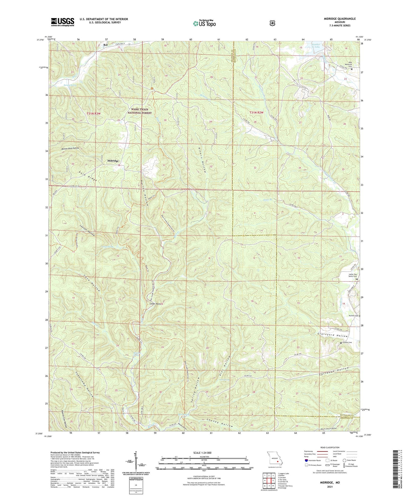
Midridge Missouri US Topo Map
Couldn't load pickup availability
Also explore the Midridge Forest Service Topo of this same quad for updated USFS data
2021 topographic map quadrangle Midridge in the state of Missouri. Scale: 1:24000. Based on the newly updated USGS 7.5' US Topo map series, this map is in the following counties: Shannon, Reynolds. The map contains contour data, water features, and other items you are used to seeing on USGS maps, but also has updated roads and other features. This is the next generation of topographic maps. Printed on high-quality waterproof paper with UV fade-resistant inks.
Quads adjacent to this one:
West: The Sinks
Northwest: Loggers Lake
North: Bunker
Northeast: Corridon
East: Corridon SE
Southeast: Exchange
South: Powder Mill Ferry
Southwest: Eminence
This map covers the same area as the classic USGS quad with code o37091c2.
Contains the following named places: Adair Creek Mine, Alec Hollow, Alec Spring, Barton Hollow, Bounds Branch, Cave Hollow, Cedar Point, Cedar Point School, Cheney Hollow, Graveyard Hollow, Himont, Himont Lookout Tower, Homing Creek, Jims Creek, Latter Day Saints Church, Laxton Hollow, Laxton Spring, McIntire Spring, McIntire Spring Branch, McIntire Spring House, Midridge, Ozark Lead Tailings Dam, Polk Church, Polk Ridge, Rat, Rivers Hollow, Spout Spring, Spring Hollow, Suses Branch, Sweetwater Church, Swiney Spring, Township of Moore, Woods Hollow