MyTopo
Fidelity Missouri US Topo Map
Couldn't load pickup availability
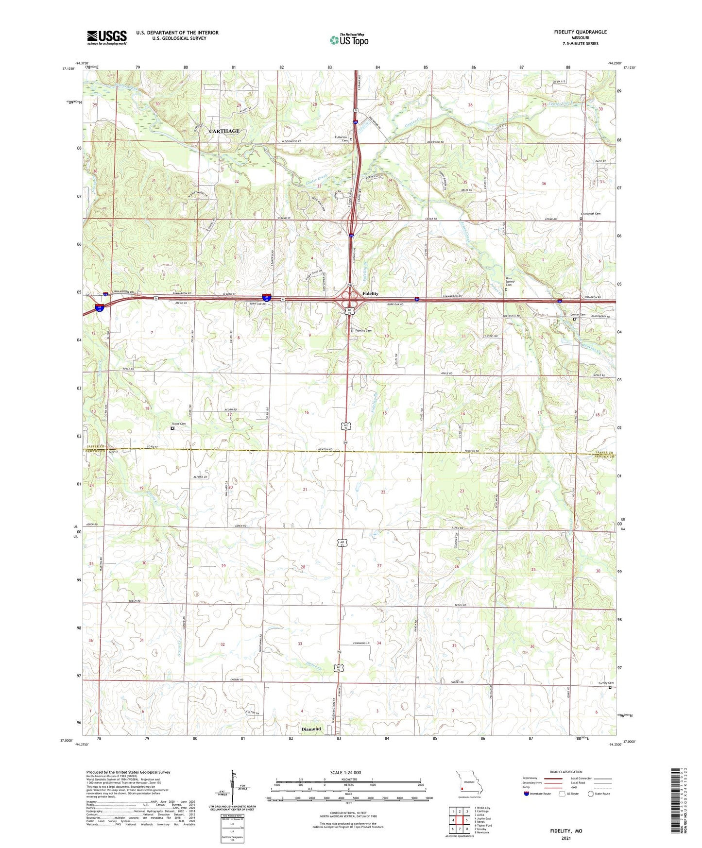
2021 topographic map quadrangle Fidelity in the state of Missouri. Scale: 1:24000. Based on the newly updated USGS 7.5' US Topo map series, this map is in the following counties: Jasper, Newton. The map contains contour data, water features, and other items you are used to seeing on USGS maps, but also has updated roads and other features. This is the next generation of topographic maps. Printed on high-quality waterproof paper with UV fade-resistant inks.
Quads adjacent to this one:
West: Joplin East
Northwest: Webb City
North: Carthage
Northeast: Avilla
East: Reeds
Southeast: Newtonia
South: Granby
Southwest: Tipton Ford
Contains the following named places: Berean School, Brown School, Browns, Center Church, Church of God, Diamond Grove Church, Emanuel Church, Excelsior School, Farney Cemetery, Fidelity, Fidelity Branch, Fidelity Cemetery, Fidelity School, Fullerton Cemetery, Jenkins Creek, Jones Creek, KKLL-AM (Webb City), Liberty Church, Liberty Community Hall, Modern School, Moss Springs Cemetery, Moss Springs Picnic Area, Pearl Hill School, Stone Cemetery, Stony Point School, Town of Fidelity, Township of Jackson, Township of Marion, Victory School, ZIP Code: 64840