MyTopo
Granby Missouri US Topo Map
Couldn't load pickup availability
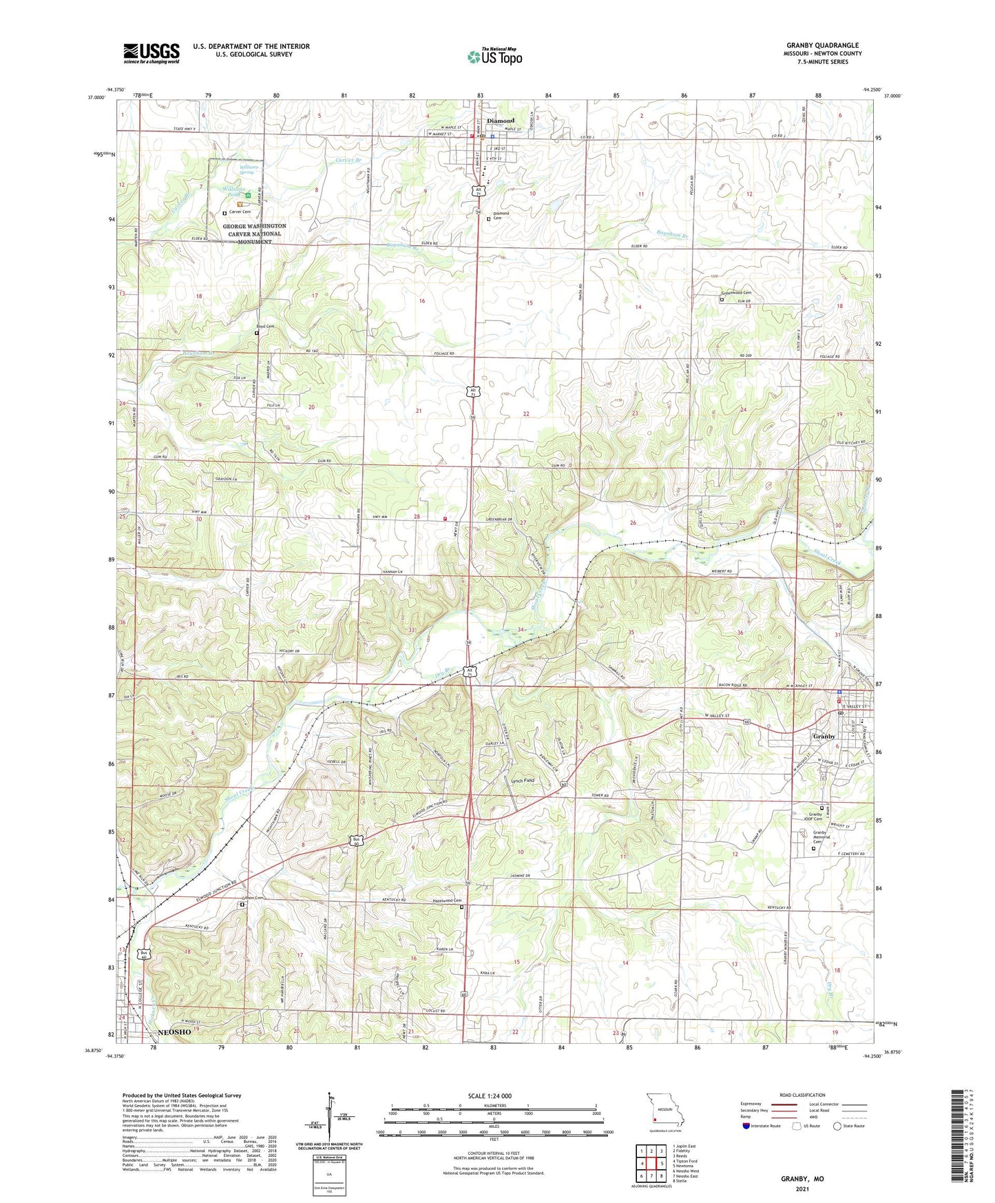
2021 topographic map quadrangle Granby in the state of Missouri. Scale: 1:24000. Based on the newly updated USGS 7.5' US Topo map series, this map is in the following counties: Newton. The map contains contour data, water features, and other items you are used to seeing on USGS maps, but also has updated roads and other features. This is the next generation of topographic maps. Printed on high-quality waterproof paper with UV fade-resistant inks.
Quads adjacent to this one:
West: Tipton Ford
Northwest: Joplin East
North: Fidelity
Northeast: Reeds
East: Newtonia
Southeast: Stella
South: Neosho East
Southwest: Neosho West
This map covers the same area as the classic USGS quad with code o36094h3.
Contains the following named places: Birthplace Site, Boyd Cemetery, Carver Bust, Carver Cemetery, City of Granby, Croutchs Spur, Diamond, Diamond Area Fire Protection District Station 1, Diamond Area Fire Protection District Station 2, Diamond Cemetery, Diamond Elementary School, Diamond Grove Prairie, Diamond High School, Diamond Middle School, Diamond Police Department, Diamond Post Office, Dry Branch, East Newton Fire Protection District, Eighteen Eighty-One Moses Carver House, Field Early Childhood and Kindergarten Center, George Washington Carver National Monument, Gibson Cemetery, Granby, Granby City, Granby Elementary and Junior High School, Granby Fire Department, Granby Memorial Cemetery, Granby Police Department, Granby Post Office, Greenwood Cemetery, Greenwood School, Hazelwood Cemetery, Hickory Creek, Kiddo School, Kiddo Spur, Lynch Field, Neosho Station, Newton County, Shepherd Airport, Silver Moon Church, Silver Moon School, Spencer Branch, Town of Diamond, Township of Granby, Williams Branch, Williams Pond, Williams Spring