MyTopo
Tipton Ford Missouri US Topo Map
Couldn't load pickup availability
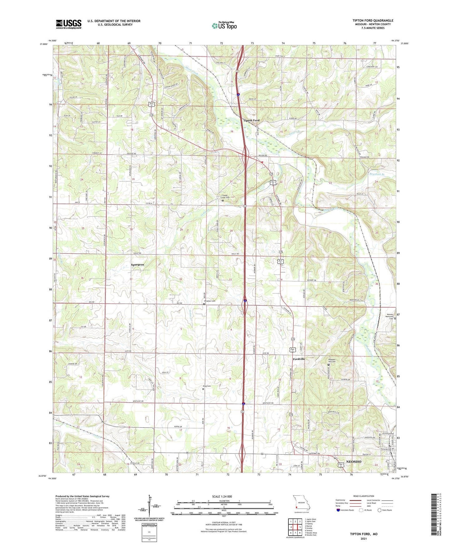
2021 topographic map quadrangle Tipton Ford in the state of Missouri. Scale: 1:24000. Based on the newly updated USGS 7.5' US Topo map series, this map is in the following counties: Newton. The map contains contour data, water features, and other items you are used to seeing on USGS maps, but also has updated roads and other features. This is the next generation of topographic maps. Printed on high-quality waterproof paper with UV fade-resistant inks.
Quads adjacent to this one:
West: Racine
Northwest: Joplin West
North: Joplin East
Northeast: Fidelity
East: Granby
Southeast: Neosho East
South: Neosho West
Southwest: Seneca
This map covers the same area as the classic USGS quad with code o36094h4.
Contains the following named places: Alcora, Baynham Branch, Black Jack School, Brock Prairie, Burkhart Prairie, Carver Branch, Cave Spring Church, Cave Spring School, Cedar Creek, Cedar Creek Cemetery, Cedar Creek Church, Cedar Creek School, Fredville, Hammers School, Hill Dale School, Hilldale Church, Kenney Memorial Cemetery, King Cemetery, Mormon Church, Oak Dale School, Oak Grove Chapel, Oak Grove Church, Oak Grove School, Pleasant Hill Cemetery, Redings Mill Fire Protection District Station 4, Schoenborn School, Spring Valley Church, Spring Valley School, Spurgeon, Spurgeon Prairie, Spurgeon School, Thrasher Cemetery, Tipton Ford, Township of Neosho, Wildwood Church