MyTopo
Newtonia Missouri US Topo Map
Couldn't load pickup availability
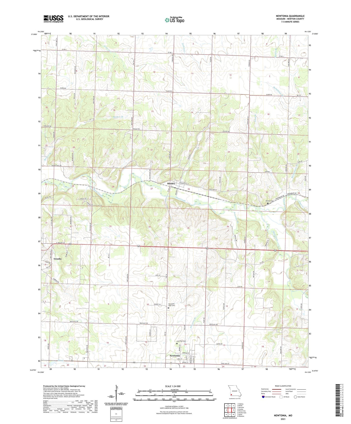
2021 topographic map quadrangle Newtonia in the state of Missouri. Scale: 1:24000. Based on the newly updated USGS 7.5' US Topo map series, this map is in the following counties: Newton. The map contains contour data, water features, and other items you are used to seeing on USGS maps, but also has updated roads and other features. This is the next generation of topographic maps. Printed on high-quality waterproof paper with UV fade-resistant inks.
Quads adjacent to this one:
West: Granby
Northwest: Fidelity
North: Reeds
Northeast: Sarcoxie
East: Pierce City
Southeast: Wheaton
South: Stella
Southwest: Neosho East
This map covers the same area as the classic USGS quad with code o36094h2.
Contains the following named places: Cedar Bluff School, Civil War Cemetery, Clear Creek, Douthit Branch, East Newton High School, East Union School, Green Valley School, Mound Chapel, Mountain Grove Church, Newtonia, Newtonia Branch, Nimmo Cemetery, Number 40 Dam, Park, Pryor Branch, Ritchey, Town of Newtonia, Town of Ritchey, Township of Van Buren, Van Buren Church, West Union Church, West Union School, Wurmington Branch, ZIP Code: 64844