MyTopo
Ford City Missouri US Topo Map
Couldn't load pickup availability
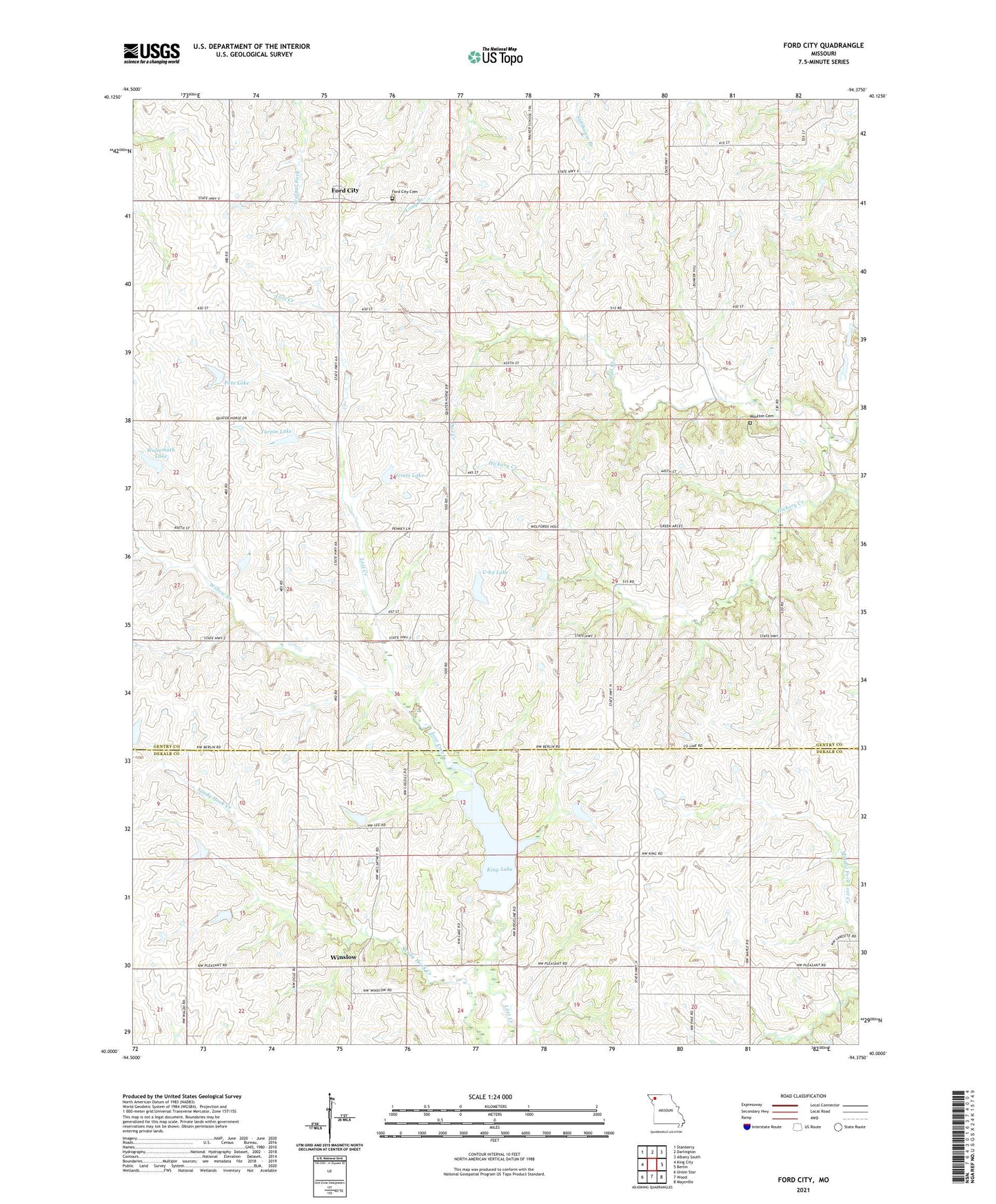
2021 topographic map quadrangle Ford City in the state of Missouri. Scale: 1:24000. Based on the newly updated USGS 7.5' US Topo map series, this map is in the following counties: Gentry, DeKalb. The map contains contour data, water features, and other items you are used to seeing on USGS maps, but also has updated roads and other features. This is the next generation of topographic maps. Printed on high-quality waterproof paper with UV fade-resistant inks.
Quads adjacent to this one:
West: King City
Northwest: Stanberry
North: Darlington
Northeast: Albany South
East: Berlin
Southeast: Maysville
South: Wood
Southwest: Union Star
Contains the following named places: Bryson Lake Dam, C-63 Lake, Dewey-Sumner School, Eiberger Lake Dam, Ford City, Ford City School, Grindstone-Lost-Muddy Creek Watershed Dam C-27, Grindstone-Lost-Muddy Creek Watershed Dam C-28, Grindstone-Lost-Muddy Creek Watershed Dam C-29, Grindstone-Lost-Muddy Creek Watershed Dam C-3, Grindstone-Lost-Muddy Creek Watershed Dam C-35, Grindstone-Lost-Muddy Creek Watershed Dam C-36, Grindstone-Lost-Muddy Creek Watershed Dam C-39, Grindstone-Lost-Muddy Creek Watershed Dam C-60, Grindstone-Lost-Muddy Creek Watershed Dam C-63, Heintz Lake, King Lake, Law Lake Dam, Liberty School, Maple Grove School, Millen School, Owl Creek, Pate Lake, Pence School, Pleasant Hill Church, Pleasant Hill School, Shepherd School, Turpin Lake, Waltemath Lake, Willow Creek, Winslow, ZIP Code: 64463