MyTopo
Union Star Missouri US Topo Map
Couldn't load pickup availability
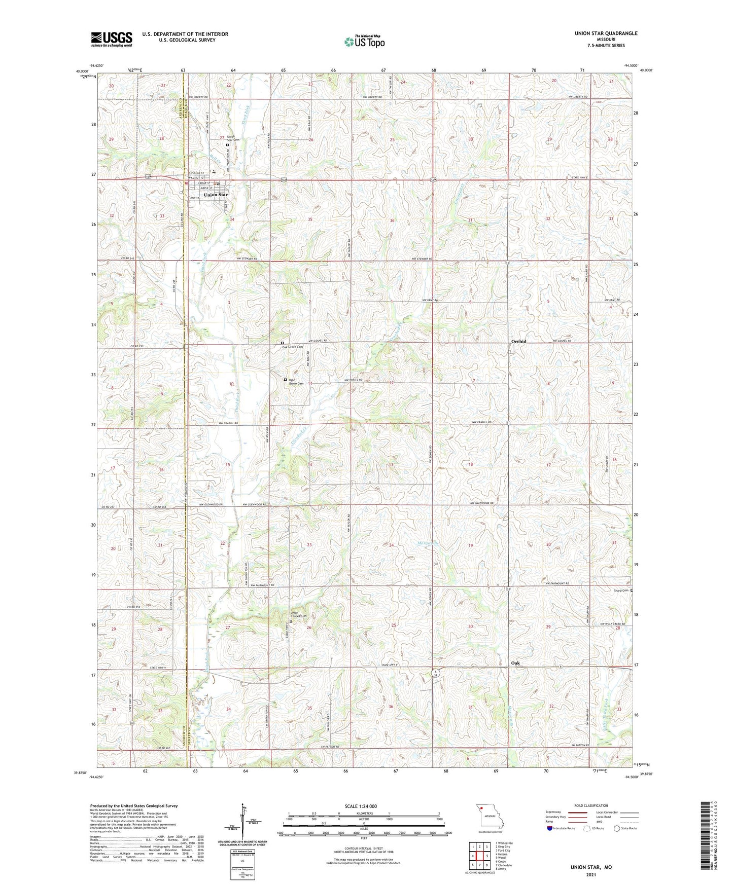
2021 topographic map quadrangle Union Star in the state of Missouri. Scale: 1:24000. Based on the newly updated USGS 7.5' US Topo map series, this map is in the following counties: DeKalb, Andrew. The map contains contour data, water features, and other items you are used to seeing on USGS maps, but also has updated roads and other features. This is the next generation of topographic maps. Printed on high-quality waterproof paper with UV fade-resistant inks.
Quads adjacent to this one:
West: Helena
Northwest: Whitesville
North: King City
Northeast: Ford City
East: Wood
Southeast: Amity
South: Clarksdale
Southwest: Cosby
This map covers the same area as the classic USGS quad with code o39094h5.
Contains the following named places: Bowen School, Bull Creek, Center School, Crooked Creek, Franklin School, Glenwood School, Mount Moriah Church, Oak, Oak Grove Cemetery, Oak Grove Church, Oak Grove School, Ogle Grove Cemetery, Orchid, Orchid School, Sharp Cemetery, Sharp School, Taylor School, Town of Union Star, Township of Polk, Township of Sherman, Union Chapel Cemetery, Union Chapel School, Union Star, Union Star Cemetery, Union Star Elementary School, Union Star Fire Protection District, Union Star High School, Union Star Post Office, ZIP Code: 64494