MyTopo
Maynard Arkansas US Topo Map
Couldn't load pickup availability
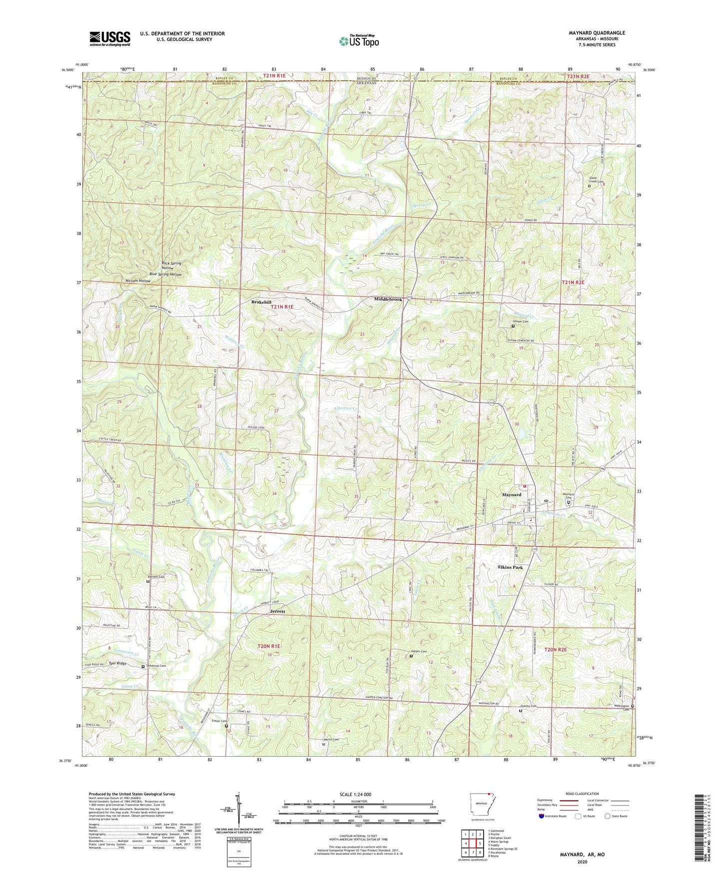
2024 topographic map quadrangle Maynard in the state of Arkansas. Scale: 1:24000. Based on the newly updated USGS 7.5' US Topo map series, this map is in the following counties: Randolph, Ripley. The map contains contour data, water features, and other items you are used to seeing on USGS maps, but also has updated roads and other features. This is the next generation of topographic maps. Printed on high-quality waterproof paper with UV fade-resistant inks.
Quads adjacent to this one:
West: Warm Springs
Northwest: Gatewood
North: Poynor
Northeast: Doniphan South
East: Supply
Southeast: Reyno
South: Pocahontas
Southwest: Ravenden Springs SE
Contains the following named places: Albritten Creek, Barnett Cemetery, Blue Spring Hollow, Brakebill, Brakebill Church of Christ, Camp Creek, Columbia Jarrett Baptist Church, Dry Creek, Elkins Park, Foster Cemetery, Glaze Creek, Glaze Creek Cemetery, Glaze Creek Church of Christ, Hagood Creek, Harper Cemetery, Jarrett School, Jerrett, Lewis Creek, Martin Cemetery, Maynard, Maynard Cemetery, Maynard Elementary School, Maynard High School, Maynard Post Office, Maynard Volunteer Fire Department, Middlebrook, Middlebrook United Methodist Church, Mock, Mud Creek, Niccum Hollow, Old Siloam, Overby Cemetery, Overby Church, Rock Spring Hollow, Salem Baptist Church, Shaver Creek, Siloam Cemetery, Siloam Church, Sparkman Cemetery, Spencer Creek, Spring Creek, Tattle Creek, Tennessee Creek, Town of Maynard, Township of Ingram, Township of Siloam, Waldron Creek, Washington, Washington Cemetery, Washington Church of Christ, Washington School, Wright Creek