MyTopo
Gilman City East Missouri US Topo Map
Couldn't load pickup availability
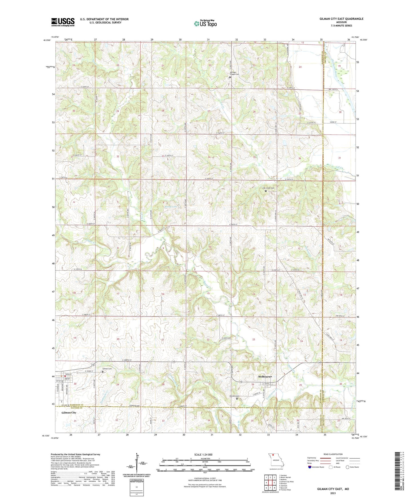
2021 topographic map quadrangle Gilman City East in the state of Missouri. Scale: 1:24000. Based on the newly updated USGS 7.5' US Topo map series, this map is in the following counties: Harrison, Grundy, Daviess. The map contains contour data, water features, and other items you are used to seeing on USGS maps, but also has updated roads and other features. This is the next generation of topographic maps. Printed on high-quality waterproof paper with UV fade-resistant inks.
Quads adjacent to this one:
West: Gilman City West
Northwest: Gardner
North: Mount Moriah
Northeast: Modena
East: Brimson
Southeast: Trenton West
South: Bancroft
Southwest: Jameson
Contains the following named places: Bolton, Bolton Post Office, Bolton School, Cat Creek Cemetery, City of Gilman City, Cole School, Fox Creek, Gilman Cemetery, Gilman City, Gilman City Elementary School, Gilman City Fire Protection District, Gilman City High School, Gilman City Post Office, Lake Church, Lake School, Little Creek, Long Branch, Melbourne, Metcalf School, Mitchell Cemetery, Mitchell Church, Ratliff Lake, Ratliff Lake Dam, Rock Island School, Spring Hill School, Springer Chapel, Springer Chapel Cemetery, Stephen School, Theusen Lake Dam, Tombstone Creek, Township of Fox Creek, Township of Sugar Creek, Union Church, Wayne Helton Memorial State Wildlife Area, Woodworth Lake Dam, Wynne Lake Dam, ZIP Code: 64642