MyTopo
Bancroft Missouri US Topo Map
Couldn't load pickup availability
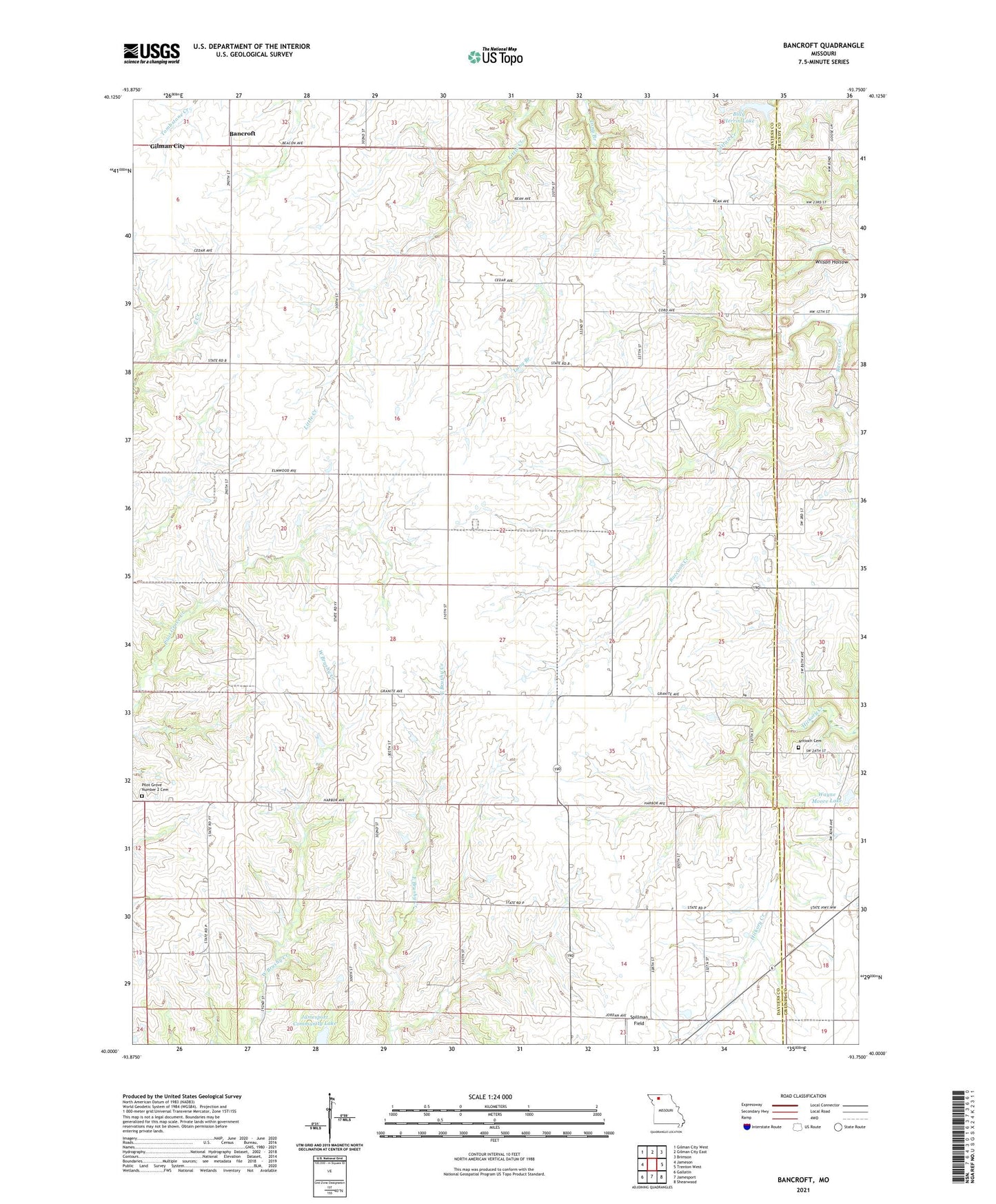
2021 topographic map quadrangle Bancroft in the state of Missouri. Scale: 1:24000. Based on the newly updated USGS 7.5' US Topo map series, this map is in the following counties: Daviess, Grundy. The map contains contour data, water features, and other items you are used to seeing on USGS maps, but also has updated roads and other features. This is the next generation of topographic maps. Printed on high-quality waterproof paper with UV fade-resistant inks.
Quads adjacent to this one:
West: Jameson
Northwest: Gilman City West
North: Gilman City East
Northeast: Brimson
East: Trenton West
Southeast: Shearwood
South: Jamesport
Southwest: Gallatin
This map covers the same area as the classic USGS quad with code o40093a7.
Contains the following named places: Antioch Cemetery, Antioch Church, Ashbrook Chapel, Bancroft, Billy Herrin Lake, Boyd School, Charity School, Gates Lake Dam, Griffin School, Liberty School, McCarty Lake Dam, Mount Pleasant School, Pilot Grove Number 1 Church, Pilot Grove Number 2 Cemetery, Pilot Grove Number Two Church, Pilot Grove School, Pleasant Grove School, Prairie Center School, Red School, Township of Jamesport, Township of Lincoln, Wayne Moore Lake, Wilson Hollow