MyTopo
Grant City Missouri US Topo Map
Couldn't load pickup availability
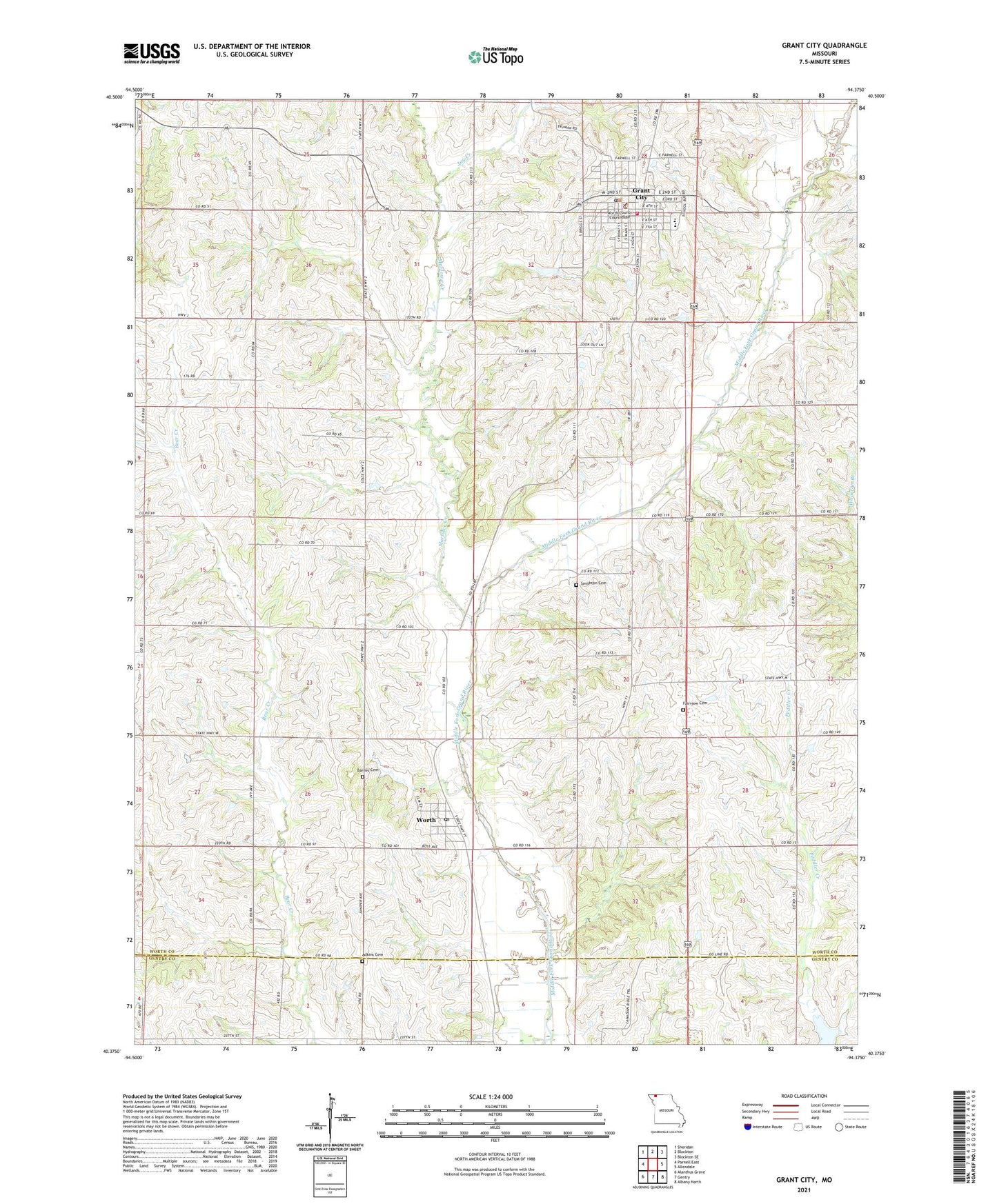
2021 topographic map quadrangle Grant City in the state of Missouri. Scale: 1:24000. Based on the newly updated USGS 7.5' US Topo map series, this map is in the following counties: Worth, Gentry. The map contains contour data, water features, and other items you are used to seeing on USGS maps, but also has updated roads and other features. This is the next generation of topographic maps. Printed on high-quality waterproof paper with UV fade-resistant inks.
Quads adjacent to this one:
West: Parnell East
Northwest: Sheridan
North: Blockton
Northeast: Blockton SE
East: Allendale
Southeast: Albany North
South: Gentry
Southwest: Alanthus Grove
Contains the following named places: Adkins Cemetery, Barnes Cemetery, Bressler School, Center South School, Croce Lake Dam, Fairview Cemetery, Gabriel Lake Dam, Gabriel Lake Dam South, Gladstone Lake East Dam, Gladstone Lake West Dam, Grant City, Grant City Dam, Grant City East Dam, Grant City Post Office, Hayden Lake Dam, Holmes Lake Dam, Jay Creek, Jay Lake Dam North, Jay Lake Dam South, Leonard School, Maple Grove School, Marlowe Creek, McKean School, Miller Lake Dam, Mount Waller, Peddler School, Prairie Star School, Prather Lake East Dam, Prather Lake West Dam, Prohibition City, Salmon School, Sheridan School, Smithton Cemetery, Smithton School, Town of Grant City, Township of Middlefork, Village of Worth, Willhite School, Worth, Worth County, Worth County Elementary School, Worth County Fire Protection District, Worth County High School, Worth County Sheriff's Office, ZIP Codes: 64456, 64499